Monday, October 16, 2017

Teotihuacan - A photo album

As the rainy season approaches its end in Mexico, I wanted to share a few pictures to convey the beauty and mystery of Teotihuacan.  
I can only recommend to anyone interested in having the best photographic experience of this ancient site to visit in the Fall, when the heavy rain makes the colors come to life and the day alternates clouds and sun. If you arrive early on a weekday, you may also have the chance of being the only visitor there - a truly magical experience which is very well worth the early wake-up. 

View towards the Avenue of the Dead from the Pyramid of the Moon. [Photo by Author]
Platforms along the Avenue of the Dead, with the Pyramid of the Sun in the background. [Photo by Author]
View across the Plaza of the Moon towards the Pyramid of the Sun. [Photo by Author]
Only a small portion of Teotihuacan has been excavated. Several unexcavated mounds dot the landscape around the main pyramid. [Photo by Author]
Another view of the Pyramid of the Sun from across the Plaza of the Moon. [Photo by Author]
The Pyramid of the Moon, with the Cerro Gordo in the background, as seen from the top of the Pyramid of the Sun. [Photo by Author]
A strangely deserted Avenue of the Dead looking towards the Pyramid of the Moon. The Cerro Gordo mountain is in the background, still covered in the morning mist. [Photo by Author]
A view of the Pyramid of the Moon from across the Plaza. [Photo by Author]
The Pyramid of the Sun, from the distance across a vast expanse of grass. [Photo by Author]
The monumental stairway of the Pyramid of the Feathered Serpents, with its spectacular sculptured decoration. [Photo by Author]


Monday, October 2, 2017

Join us on our next Expeditions

An Update on Upcoming Expeditions

The objective of this post is to share more details on some of our upcoming expeditions that may help unravel the mystery of the origins of the great and still largely unknown megalithic civilization of the Central Mexican highlands. Many of these locations are of difficult access, in remote or impervious terrain. We need motivated people to help us conduct these expeditions on the ground and document these ancient sites (with photos, videos and aerial images) – many of which have not been published before.  

Anyone interested should contact me in private at the address: unchartedruinsblog@gmail.com

Here is an initial list of sites for investigation, with some preliminary information on their significance to our quest for the lost megalithic civilization.    

1) Exploration of the Sierra de Huautla, Morelos

The construction of the walls of Chimalacatlan in an old postcard drawing [Courtesy: Mexicoenfotos.com]
We believe that the center of the megalithic civilization of ancient Mexico must be located somewhere in the still unexplored reaches of the Sierra de Huautla, a mountainous and heavily forested area to the South of the State of Morelos. This is where ancient legends located Tamoanchan, the fabulous “place of origin” of all Mesoamerican civilization – a city founded by the Gods themselves. 

In February of 2015 we explored the mysterious ruins of Chimalacatlan in the Sierra de Huautla (Link here). This is a unique megalithic site consisting of immense stone walls and platforms occupying the summit of a hill. For its cyclopean style of construction, Chimalacatlan has been compared to some of the finest megalithic constructions of Peru, and is of a type entirely unknown in Mesoamerica. The age of these ruins is unknown, but early investigators of the site conservatively situated their origin in the 1st or 2nd millennium B.C. More reports have since surfaced on the existence of more extensive structures in the mountains near the modern day town of Huaxtla. These structures have been described as clearly megalithic or cyclopean, consisting of large stone blocks measuring as much as 2 meters in length. Several pyramids, plazas and large stone walls have been reported on the site, compatible with the presence of a large city.  

The goal of the expedition will be to document and map these ruins, collect evidence for the existence of additional unexplored sites in the Sierra de Huautla and investigate their architectural analogies with other megalithic/ cyclopean structures in Mexico, Peru and elsewhere.    

Additional information from the Mexican National Institute of History and Anthropology (INAH) - Link here

2) The Lost Pyramid of Teopantepec and the “City of the Gods” on the Cerro Colorado

An illustration of the pyramid of Teopantepec, as it stood in 1807 [Dupaix, Antiquités Mexicaines, p.4, Plate 3]
In a previous article (Link here), we identified the Cerro Colorado overlooking the modern day town of Tehuacan, Puebla, as the most likely location of an ancient pyramid known from early 18th and 19th Century documents as Teopantepec (“House of God on the Mountain”). It is possible that the original structure collapsed some time after these early reports were composed, but some remains of its megalithic stone facing may still be found on the Cerro Colorado. Local traditions mention a “City of the Gods” or a “Ciudad Perdida (Lost City)” on the nearly inaccessible summit of the mountain. On the site of this supposed lost city, satellite pictures show a vast rectangular enclosure with what appear to be the remains of an ancient pyramid in the middle. 

The expedition will start from the nearby archaeological site of Tehuacan Viejo, from which a trail leads to the summit of the Cerro Colorado. It can probably be completed as a day-trip from Puebla.   

3) Acatzingo de la Piedra – A monolithic pyramid and cyclopean walls 

A short distance from the town of Malinalco (subject of another article – here), lies the town of Tenancingo and the site of Acatzingo de la Piedra. A monolithic stone pyramid has been recently found on the mountain known locally as the “Cerro de la Malinche”. The pyramid is known as the “Cama de Moctezuma”, and a number of pictures and videos of it exist over the internet. Other pictures show what appear to be portions of megalithic/ cyclopean walls partly covered by forest. 

We will use a drone to map any structures that might exist closer to the summit of the hill, as well as any visible megalithic remains. This expedition can also be completed as a day-trip from Malinalco or Mexico City.   

Additional information from the Mexican National Institute of History and Anthropology (INAH) - Link here

4) Mexico’s Marcahuasi – The Sacred Valley of Tepoztlán

A satellite view of the Valley of Tepoztlan, with the Popocatepetl volcano in the background [Courtesy Google Earth]
Unbeknown to many, the famous Peruvian explorer Daniel Ruzo, who first documented and publicized the mysterious rock sculptures on the plateau of Marcahuasi, spent the last years of his life in Mexico in what he called the “Sacred Valley of Tepoztlán”. There, he believed that rock sculptures even larger and older than those of Marcahuasi existed in the mountains surrounding the town of Tepoztlán. He documented hundreds of colossal rock sculptures, forming what he called a “hidden blueprint” or a map pointing to the location of a legendary “Hall of Records”. Since the publication of his book “El Valle Sagrado de Tepoztlán”, the valley has however failed to attract a similar interest to its Peruvian counterpart. 
   
The town of Tepoztlán, with its stunning landscapes and the enigmatic pyramid of Tepozteco, attracts thousands of tourists every year. Only very few of them, however, are aware of the research of Daniel Ruzo. The goal of our expedition will be to document many of the rock sculptures first described and photographed by Ruzo in his book, identifying signs or marks that could point to their artificial rather than natural origin. Because of the easy accessibility of Tepoztlán from Cuernavaca and Mexico City, this can also be completed through a number of day-trips from Mexico City. We will also use a drone to document the rock sculptures from the air and identify any other features not detectable from the ground. 

5) The Mysterious Rock of Apoala

The great 19th Century ethnologist and explorer Hubert H. Bancroft collected the following tradition of the “Flying Gods” of the Mixteca. After a great deluge, two gods appeared to repopulate the Earth: “They made a very sumptuous palace – a masterpiece of skill – in which they made their abode upon Earth…on the highest part of this building was an axe of copper, the edge being uppermost, and on this axe the heavens rested […] This rock and the palace of the Gods were on a mountain in the neighborhood of the town of Apoala in the province of Mixteca Alta. The rock was called ‘The Place of Heaven´, there the Gods first abode on Earth.”  [Hubert Howe Bancroft, The Native Races, Vol. IV] 

Such a rock does indeed exist in the vicinity of the modern day town of Santiago Apoala. Several deep caves associated with the legend exist in the gorges of Apoala, and a number of very curious petroglyphs and Olmec rock-reliefs (one in particular, known as the “Danzante”) are said to exist near the summit of the rock of Apoala. 

We will be looking for remains of ancient structures on or near the summit of the rock of Apoala, which may offer evidence for the existence of a “Palace of the Gods”. We will also investigate traditions of a labyrinth of ancient tunnels in a cave known locally as the “Cueva del Diablo (The Devil’s lair)”.  

Additional information and pictures can be found here.

6) An ancient obelisk and carved reliefs in Axutla, Puebla

A satellite view of the Rock of Huehuepiaxtla (Axutla, PUE), along the Rio Atoyaque [Courtesy Google Earth]
Also in the region of the Mixteca Alta, the village of Huehuepiaxtla (Axutla, PUE) is home to a colossal rocky outcrop known locally as “La Gran Peña (the great rock)”. A number of pictures have been circulating on the internet of ancient carved reliefs and stelae found in the vicinity of the mountain, containing unusual depictions of supernatural beings which were believed to inhabit its summit. It is also said that ancient structures, including a large “stone obelisk” may exist on the summit – although no documentation of these puzzling remains could be found.  

The expedition can probably be conducted as a day-trip from Puebla, with the objective of documenting many of these curious finds and confirm the existence of ancient megalithic structures near the summit of the Rock of Huehuepiaxtla.  

Additional information and pictures can be found here.

7) A journey into the Underworld of Teotihuacan

A large chamber in one of the caves that form the ancient Underworld of Teotihuacan, located a short distance to the East of the Pyramid of the Sun [Photo by Author]
There are reportedly miles of ancient tunnels and interconnected cave systems under the ancient pyramid-city of Teotihuacan. We confirmed the existence of the tunnels and explored a small portion of this labyrinthine network to the East of the pyramid of the Sun in February of 2017 (Link here). Additional tunnel entrances are reported to exist near the palatial complex of Oztoyahualco, near Acolman, on the Cerro Gordo and in the Sierra de Patlacique to the south of the ancient city (these latter apparently carved in a very hard andesite). 

Some of the tunnels are rumored to extend for many miles. Early archaeological reports speak of labyrinthine tunnels leading to vast hollowed chambers and pillared halls deep under the earth, which may have an association with the legendary Chicomoztoc, the “Place of the seven caves” considered to be the ancestral homeland from which emerged the ancestors of the Aztec tribes. 

This expedition is likely to require proper speleological equipment for the exploration of the underground passages. 

8) The mysterious subterraneans of Xochicalco

A portion of an ancient tunnel under the acropolis of Xochicalco [Photo by Author]
A number of ancient tunnels extend under the acropolis of Xochicalco, and there are also rumors of underground chambers and labyrinthine passageways running for many miles all around. Only a small portion of the tunnel system is presently open to the public (near the so-called solar observatory or “Cueva del Sol”). Other entrances can be found on the flanks of the acropolis, which lead to collapsed portions of the tunnel system (some of which we explored in April of 2017) – the tunnels are apparently very regular and are dug through a hard local kind of limestone. During the same trip we also documented large stretches of what appear to be polygonal/ cyclopean walls forming the substructure of the acropolis. The nearby Cerro de la Bodega is also said to contain a number of tunnel entrances.   

This expedition is also likely to require proper speleological equipment for the exploration of the underground passages. 

Link to a previous article on Xochicalco here

9) The Aztec sanctuary on Mount Tlaloc

A 3D reconstruction of the Aztec sanctuary on Mount Tlaloc and the "Ghost Mountain" optical illusion [Courtesy: masdemx.com]
The chief sanctuary of Tlaloc – the Aztec god of rain, was located on the mountain that bears the same name in the vicinity of Mexico City. The sanctuary on the summit, at an altitude of nearly 4,100 meters above sea level, is considered to be among the highest archaeological ruins in the world, and contains a number of significant astronomical alignments, including a long processional ramp and a ruined pyramid-observatory.

A curious optical phenomenon takes place on the summit of Mount Tlaloc during the month of February. Known as the “ghost mountain” (La Montaña fantasma), the phenomenon consists in an apparent optical mirage of a non-existing mountain in front of the peak of Mount Tlaloc.  

The hike to the summit of Mount Tlaloc does not require any special technical equipment, but one night of camping on the mountain is required.  

Additional information and pictures can be found here

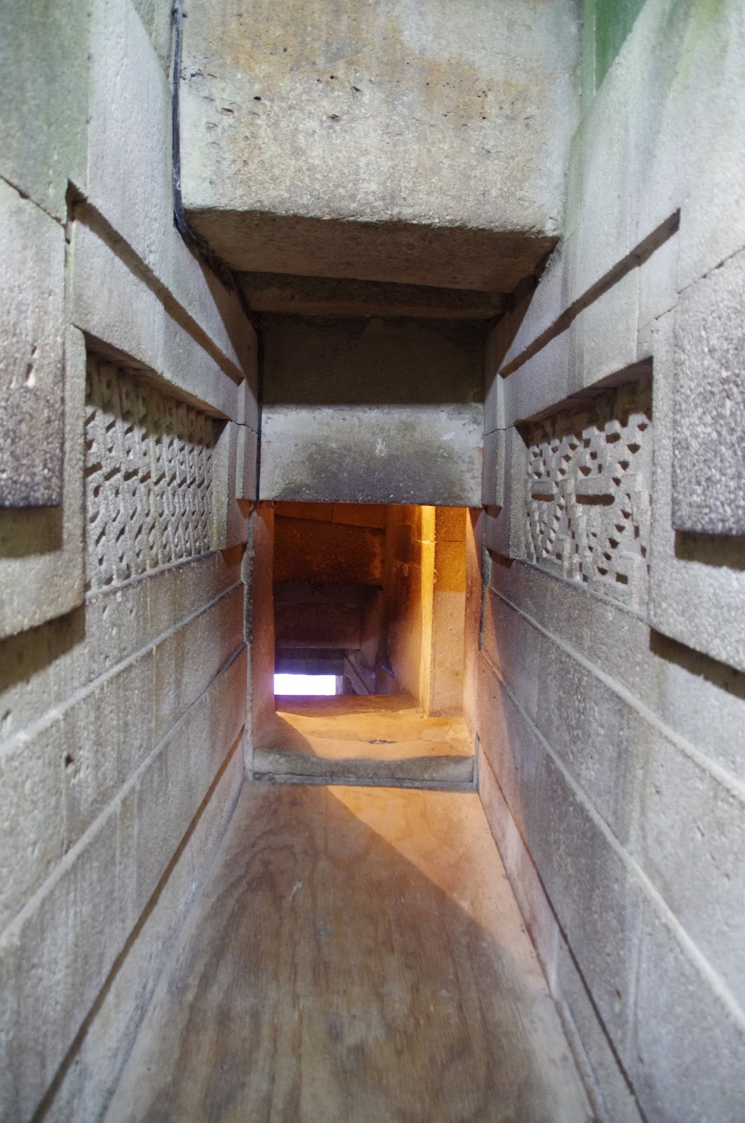
10) The search for the Cross of Xaagá 

In a previous article (Link here), we described a mysterious megalithic tomb somewhere in the vicinity of Mitla. The tomb is in the shape of a cross and consists of several immense megalithic stone blocks measuring as much as 6-7 meters long. Several black and white pictures of the alleged tomb exist, dating from the early 1900’s, but its exact location has apparently been lost. If found, the tomb would be one of the largest megalithic structures in the entire American continent. The area is also characterized by the presence of rock art and cave paintings dating back thousands of years. 

One of the few existing pictures of the large cruciform tomb at Guiaroo, dating to the time of the 1902 excavations. Each one of the immense monolithic stone blocks employed in the construction measured over 6 meters long with an estimated weight of nearly 50 tons. The location of this remarkable megalithic structure has apparently been lost. [Photo Saville, 1902]
Another view of the same structure after partial excavation, taken at an angle. [Photo Saville, 1902]
An expert guide will be required for this trek, which can probably be done on horse or mule as a day trip from Oaxaca.  

Sunday, October 1, 2017

Mysterious geoglyphs and a new pyramid at Teotihuacan?

New elements in the astronomical design of the site
The Cerro Colorado, as seen from the Pyramid of the Sun. [Courtesy: Google Earth]
The reason for Teotihuacan’s orientation 15.5° East of North has been one of the most enduring mysteries of Mesoamerican archaeology. The only answers so far have come from natural topography. The summit of the Cerro Gordo mountain, to the North-East of Teotihuacan, appears to be aligned to the Pyramid of the Sun if a perpendicular is drawn through its Northern face (Contrary to common belief, the Avenue of the Dead does not point toward the summit of the Cerro Gordo, but rather to a point slightly to the West of it). One nearby summit, the Cerro Colorado Chico, however significantly stands out for its apparent exclusion from the system of topographical alignments that characterize the ancient site. 
The Valley of Teotihuacan, as seen from the summit of the Cerro Gordo, looking South. The Cerro Colorado lies to the right in the picture, with the Patlacique Range in the background along the axis of the Avenue of the Dead. [Courtesy: Google Earth]
This is even more surprising if one considers that the Cerro Colorado is the most prominent elevation in the immediate vicinities of Teotihuacan besides the Cerro Gordo to the North and the Cerro Patlacique to the South. Because the Cerro Colorado is located due West of Teotihuacan, this would make it an excellent, and indeed the only possible natural sunset solsticial marker for an observer located on top of the Pyramid of the Sun. 

As a first step, we set out to investigate the astronomical angles of this alignment: 

  • Cerro Colorado Azimuth from Sun Pyramid: 301.91°
  • Distance from Sun Pyramid (summit-to-summit): 4.17Kms
  • Difference in elevation between Sun Pyramid and Cerro Colorado (summit-to-summit): 240m
  • Angle between Sun Pyramid and summit of Cerro Colorado: 3.294° (calculated)
Because the present Azimuth of the Summer Solstice sunset as observed from Teotihuacan is only 293.5°, the Sun would set some 8.41° to the South of the summit of Cerro Colorado, at a point near its base. 

We then focused on the Moon Pyramid instead, with the following readings:

  • Cerro Colorado Azimuth from Moon Pyramid: 291.64°
  • Distance from Moon Pyramid (summit-to-summit): 3.77Kms
  • Difference in elevation between Moon Pyramid and Cerro Colorado (summit-to-summit): 246m
  • Angle between Moon Pyramid and summit of Cerro Colorado: 3.733° (calculated)
The observed Azimuth of 291.64° is much closer to the target 293.5° (the difference being less than ), which would make the Cerro Colorado a fairly accurate solsticial marker for an observer located on the summit of the Moon Pyramid at sunset. 

The Summer Solstice sunset as seen from the top of the Pyramid of the Moon [Courtesy: Google Earth]
Geoglyphs and a possible pyramid

We explored the summit of the Cerro Colorado using Google Earth in search of possible ancient structures that could have served as astronomical markers to validate the alignment. To our surprise, the images revealed what appears to be a pyramid platform located on top of the mountain, at an altitude of 2,597 meters above sea level. The pyramid measures an apparent 10 meters on each side, consists of two or possibly three superimposed bodies and has what appears to be a stairway facing to the South-East. Interestingly, a line drawn through this stairway points directly towards the summit of the Pyramid of the Sun.  
The location of the possible Pyramid on top of the Cerro Colorado. The building is precisely aligned towards the Pyramid of the Sun, some 4 kilometers away. [Courtesy: Google Earth]
Immediately below the “pyramid”, we also identified an immense geoglyph, measuring over 150 meters in length, also facing the valley and the Pyramid of Teotihuacan to the South-East. The geoglyph consists of three squares delimited by what appear to be dry-stone walls, each containing a glyph and a number of abstract symbols. The rightmost quadrant contains a “X” shape with symbols in the upper and lower portion (the one below resembling the letter “S”). The glyphs in the center and leftmost quadrant are of more difficult interpretation. 
A view of the geoglyphs near the summit of the Cerro Colorado [Courtesy: Google Earth]
There seems to be no mention of structures (either ancient or modern) near the summit of the Cerro Colorado, nor of geoglyphs on its slopes. Even though it is possible that the geoglyphs are of modern origin (drawn by whom and why?), the location of the “pyramid” on the summit of the Cerro Colorado and its alignment to the Sun Pyramid are certainly interesting in light of its possible astronomical significance. 

Only an expedition on the ground can solve the question of whether these are indeed ancient structures and their relationship to the nearby Teotihuacan pyramids. 

Monday, August 7, 2017

The Megalithic Ruins of Ancient Mexico - Part III

The Lost tombs of Mitla
The main entrance to the "Columns Group" at the ancient site of Mitla. [Photo by Author]
The archaeological site of Mitla is among the better known to travelers and explorers of ancient Mesoamerica since at least the early 18th Century, when its constructions were first sketched and described. The site is unique for its peculiar megalithic architecture and stone mosaics, which are found in a remarkable state of preservation. This is due to the structures being in uninterrupted use for centuries after the Spanish conquest and almost to the present day.  

The origins of Mitla are unknown. Although most of the structures visible today may date to the Post-Classic period (9th-12th Century AD), prehistoric cliff paintings and traces of human habitation in the area date at least to 3,000 BC (Caballito Blanco and Yagul). 

The present ruins of Mitla are clustered around four main palatial groups, sharing a similar plan consisting of three to four structures facing a central courtyard. These are known as the “Church Group”, the “Arroyo Group”, the “Adobe Group” and the “Columns Group”. The most remarkable feature of these structures is the exceptional quality of the stone workmanship and the use of extremely large megalithic stones. The walls of the structures are lined with beautiful and exceedingly intricate stone mosaics, perhaps in the imitation of textiles. Thousands of perfectly cut, polished and fitted stones were employed for the realization of each mosaic panel. In some cases, the walls were painted in what archaeologists have labelled as “Codex style”, for its similarity with the coeval Mixtec codices and manuscripts. 
A detail of some of the intricate stone mosaics that decorate the outer walls of the “Columns Group”. One also notices the extreme quality of the stone workmanship and the remarkable state of preservation of the Prehispanic structures. [Photo by Author]
Another view taken from the East side of the "Columns Group", also showing part of the high podium that sustains the structures above. [Photo by Author]
A view of the main pillared hall inside the “Columns Group”. Each one of the massive basalt columns visible in the picture has an estimated weight of over 15 tons and an height of between 4 and 5 meters. [Photo by Author]
A view into one of the side chambers of the “Columns Group”, showing more of the intricate mosaics and sculpted decoration on the inner walls. [Photo by Author]
Some of the delicate carvings and stone mosaics framing a doorway inside the “Columns Group”. The mosaic decoration was probably realized in the imitation of textile designs and was originally painted in bright colors of which only faint traces remain. [Photo by Author]
Another particular of the same doorway, seen from the front. [Photo by Author]
Some of the monolithic lintels employed in the palaces, particularly the “Columns Group”, measure as much as 6 meters long with an estimated weight in excess of 30 tons. The stone is a very hard basalt, coming from quarries located at a distance of between 5 and 10 kilometers on the opposite side of the valley. From the same stone were also quarried a number of monolithic columns, which have a fluted appearance and measure from 4 to 5 meters high. 

Mitla’s real “Temple of Doom”

The most remarkable examples of megalithic architecture and the finest stone workmanship visible anywhere at Mitla are found in some of the subterranean chambers that extend under the floor of the palaces themselves. These chambers generally follow a cruciform plan, with four long arms departing from the center. The remarkable precision of the stone cut, the polish and jointing of the stones is the finest in all of Mesoamerica and among the finest found at any megalithic site elsewhere in the world. 
The joints between the stones are so tight that not a sheet of paper would fit between two blocks, while the intricacy of the sculpted decoration and the angles at which the stones interlock are a source of constant wonder. Unlike the stone mosaics in the palaces above, which consist of hundreds of minuscule stone tiles, the panels in the underground chambers are entirely monolithic, each consisting of a single immense stone block delicately carved in the imitation of curious arabesques and geometrical patterns. 
A view towards the entrance corridor of the same chamber, framed by sculptured panels. [Photo by Author]
More details of the same passageway. [Photo by Author]
More details of the same passageway. [Photo by Author]
Several details of the cornerstones of one of the subterranean passages, from which it is possible to appreciate the extraordinary quality of the stone workmanship of these chambers and the air-tight joints between the large megalithic stone blocks that form the walls and ceilings of these subterranean chambers. [Photo by Author]
One of the subterranean chambers of the “Columns group”. Notice the enormous size and the perfect fitting of the monolithic lintel above the entrance, and also the immense monolithic slab forming the roof of the chamber. [Photo by Author]
The 16th Century Spanish priest Father Torquemada, who left an account of the ruins of Mitla, described the peculiar arrangement of the subterranean chambers of one of the palaces. 

The last (underground) chamber had a second door at the rear, which led to a dark and gruesome room. This was closed with a stone slab, which occupied the whole entrance. Through this door they, threw the bodies of the victims and of the great lords and chieftains who had fallen in battle…and so great was the barbarous infatuation of those Indians that, in the belief of the happy life which awaited them, many who were oppressed by diseases or hardships begged this infamous priest to accept them as living sacrifices and allow them to enter through that portal and roam about in the dark interior of the mountain, to seek the feasting-places of their forefathers. […] And the unhappy man, wandering in that abyss of darkness, died of hunger and thirst, beginning already in life the pain of his damnation, and on account of this horrible abyss they called this village Liyobaa. [1]”   

The same account continues with the following story: 

When later there fell upon these people the light of the Gospel, its servants took much trouble to instruct them, and to find out whether this error, common to all these nations, still prevailed; and they learned from the stories which had been handed down that all were convinced that this damp cavern extended more than thirty leagues underground, and that its roof was supported by pillars. And there were people, zealous prelates anxious for knowledge, who, in order to convince these ignorant people of their error, went into this cave accompanied by a large number of people bearing lighted torches and firebrands, and descended several large steps. And they soon came upon many great buttresses which formed a kind of street. They had prudently brought a quantity of rope with them to use as guiding-lines, that they might not lose themselves in this confusing labyrinth. And the putrefaction and the bad odour and the dampness of the earth were very great, and there was also a cold wind which blew out their torches. And after they had gone a short distance, fearing to be overpowered by the stench, or to step on poisonous reptiles, of which some had been seen, they resolved to go out again, and to completely wall up this back door of hell. The four buildings above ground were the only ones which still remained open, and they had a court and chambers like those underground; and the ruins of these have lasted even to the present day. [1]

While the account of the old Spanish priest appears credible in light of the accurate descriptions of the palaces above ground and the certain existence of vast caverns in the vicinity of Mitla, none of the subterranean chambers that have been explored to this day seems to match the description. 

Marshall H. Saville, author of the first scientific excavations at Mitla in 1902, identified the palace described by Torquemada in his account as part of the “Columns Group”, doubtless the most imposing of the palaces at Mitla. This is the only palace possessing a substructure consisting of two cruciform tombs. However, none of these possess hidden chambers or communicate with any underground labyrinth or cavern; an evidence which led Saville to dismiss the account of Torquemada as either entirely fictional or greatly exaggerated. [2]  

In our opinion, Saville might have been mistaken in identifying the “Columns Group” with the “Palace of the Living and the Dead” described by Torquemada as the access to the great cavern of Liyobaa. For a number of reasons, the “Church Group”, although now severely dilapidated, appears to be a more likely candidate. In its original state, this palace occupied a much larger area than the “Columns Group”, consisting of various interconnecting courtyards. A number of monolithic columns testify to the fact that this palace also possessed similar pillared halls that have not survived. More interesting still is the presence of the Catholic church of San Pablo directly above one of the courtyards of the Prehispanic structure. This is particularly evident from aerial photographs of the site. The position of the church altar is particularly interesting for its location on the Western side of the courtyard, facing what must have been the façade of one the palaces. There, some massive monolithic lintels are still visible in the church walls. One of the subterranean chambers of the "Columns Group" has its entrance in the same position to the West of the courtyard which is presently occupied by the altar of the Catholic Church. Churches and chapels were frequently built over the Prehispanic remains as a way of “exorcising” the demons of the old religion. It would only make sense that the Spanish missionaries would have chosen the most important and prominent of the old Mixtec palaces as the location for their church. Access to the great cavern of Liyobaa may therefore still be possible through some walled-up passage located directly under the altar of the Church of San Pablo.    
Some aerial pictures of the main palaces of Mitla in the area of the “Church Group”, showing the placement of the Catholic church on top of Prehispanic structures. [Photo by Author]
Another aerial picture of the same area, from which it is possible to appreciate the location of the main altar of the modern church on the western side of the palace. [Photo by Author]
A couple of monolithic columns still standing outside of the “Church Group”, next to a wall decorated with fine stone mosaics. [Photo by Author]
A detail of the Prehispanic structures incorporated in the lower walls of the church of San Pablo. The massive monolithic lintels framing the entrances to the palace are still visible in their original placement. [Photo by Author] 
In search of the lost tombs

In his report of the excavations of Mitla, Saville includes a most interesting picture of a cruciform tomb at a site known as Guiaroo. The tomb appears to be constructed of immense monolithic stone blocks, delicately carved. The site is vaguely described as being located 8 Km to the North-East of Mitla, but the place name does not appear on any modern map of the area. 
One of the few existing pictures of the large cruciform tomb at Guiaroo, dating to the time of the 1902 excavations. Each one of the immense monolithic stone blocks employed in the construction measured over 6 meters long with an estimated weight of nearly 50 tons. The location of this remarkable megalithic structure has apparently been lost. [Photo Saville, 1902]
Another view of the same structure after partial excavation, taken at an angle. [Photo Saville, 1902]
In the spring of 2016, we set out to identify the mysterious tomb. All hints pointed to the village of Xaaga, located in a side valley a few kilometers outside of Mitla, as the most likely location for the tomb. Very few of the local townsfolk seemed to be familiar with ancient ruins in the area. Finally, we were taken by a local guide to the ruins of an abandoned hacienda just outside the village. There, we found the entrance to at least one tomb having a cruciform structure similar to that of the tombs at Mitla. Although this is not the tomb pictured in Saville’s article, it is an extraordinarily fine example of the same style of megalithic architecture. 
A view of the ruined hacienda of Xaaga. The entrance to the cruciform tomb is in the foreground. [Photo by Author]
The opening of the tomb. [Photo by Author]
Entrance to the cruciform tomb of Xaaga. The workmanship of the stones forming the walls and the lintel is comparable to the that of the subterranean tombs at Mitla. [Photo by Author]
Any attempt at locating Saville’s mysterious tomb or the enigmatic Guiaroo site has so far proved entirely fruitless. We are therefore left with only Saville’s description of this remarkable structure: 

A sepulcher is formed here, of massive blocks, in the form of a cross, about ten feet deep, six wide and thirty long…All the inner faces of these immense blocks are sculptured, like those at Sagá [Xaaga], while other dressed rocks are scattered about”. [2]

The quarries from which the immense stones were transported could also be found about one mile away from the tomb, for Saville writes that:

Many immense quarried stones still lie scattered about at the quarries, while others have been partially broken-out from the bedrock. The large blocks used in the construction of the cruciform chamber were transported from this place, and on the way between these two points are several large blocks which were evidently being moved to the chamber when the work ceased. [2]”   

More recent studies of the quarries in the vicinity of Mitla have revealed some enormous stone blocks measuring as much as 6.24 x 3.89 x 0.80 meters. [3]. These stones would have reached a weight of as much as 50 tons and are among the largest stone monoliths ever quarried in Mesoamerica. 
A massive megalithic portal from a tomb outside the archaeological site of Monte Alban. The architectural style and technique bear a striking resemblance to the similar to the structures at Mitla. [Photo by Author]
Another view of the same megalithic doorway, from Monte Alban. [Photo by Author]
A much cruder example of underground tomb from the site of Yagul. Both the technique of the carvings and the general workmanship of the stones appear rather crude compared to the finest examples from Mitla and Xaaga. [Photo by Author]
A legend reported by Saville is that these structures were not the work of the local population. Rather, they were built by the god Quetzalcoatl and his companions upon leaving their capital city of Tollan [2]. This white, bearded race, which the Aztecs called Toltecs (not to be confused with the historical, post-classic people of the same name), was considered to be the author of so many of the unexplained megalithic ruins still visible across Mexico and Central America, showing a style of architecture and workmanship unlike any other in Mesoamerica. 

The origin of the megalithic architecture of Mitla and the techniques employed for the quarrying and transportation of such immense stone blocks without the aid of metal tools are a mystery that still endures to this day. 

References

[1] C. Lewis-Spence, The Myths of Mexico and Peru, 1913, Chapter IV: The Maya Race and Mythology. On-line resource: http://www.sacred-texts.com/nam/mmp/mmp07.htm
[2] Marshall H. Saville, Cruciform structures of Mitla and vicinity, Putnam Anniversary Volume, 1909
[3] Nelly M. Robles García, Las Canteras de Mitla, Vanderbilt University Publications in Anthropology, No.47, 1994, Nashville, TN
[4] Mitla, encyclopedia entry – From Wikipedia: https://en.wikipedia.org/wiki/Mitla

Related Articles: 

The Megalithic Ruins of Ancient Mexico – Part I – Teotihuacanhttp://unchartedruins.blogspot.mx/2016/03/the-megalithic-ruins-of-ancient-mexico.html
The Megalithic Ruins of Ancient Mexico – Part II - Tezcotzingohttp://unchartedruins.blogspot.mx/2016/08/the-mysterious-rock-and-tunnels-of.html

Tuesday, June 20, 2017

The mysterious Underworld of Teotihuacan

What lies under the City of the Gods?


I have recently published an article on the Underworld of Teotihuacan on the Ancient Origins website. You can find the complete article here:


There are miles of natural caves and man-made tunnels under the ancient city in central Mexico, many of which remain to this day unexplored. Very much like in Egypt, there are rumors that also the pyramids of Teotihuacan are connected by means of underground passages, which may extend for a considerable distance under the valley of Mexico.

Early exploration reports describe vast chambers and pillared halls carved in the living rock, of which no indication survives in modern times. It is very well possible that some of the cave entrances to this underground labyrinth can still be found a short distance from the Pyramid of the Sun and the Pyramid of the Moon.

In february, our expedition team was able to document for the first time on video a small section of these tunnels, proving that not only do these tunnels form part of a vast network running under much of the present-day site of Teotihuacan, but that they are also unquestionably man-made.

More expeditions will be required to assess the true extent of this underground labyrinth, and whether these relatively superficial tunnels are just the tip of the iceberg of a much larger system of interconnected passageways and chambers.

Additional references: 
[1] Ancient Origins - The Rome of America - What lies under Teotihuacan?

[2] Uncharted Ruins - The Megalithic Ruins of Ancient Mexico: Teotihuacan

Sunday, April 23, 2017

The Lost Pyramids of Mexico

San Cristobal Teopantepec

The accounts of the early European exploration of Mexico, during the 18th and 19th century, are replete with descriptions of ancient pyramids, lost cities and mysterious monuments that have since disappeared or become lost.

The pyramid of Teopantepec deserves a special spot in this list of apparently vanished monuments. For its unusual style, it would very well deserve a place in the history of architecture, and it is a tragedy that so little is known of the location and ultimate fate of this remarkable monument.

In a famous drawing from Dupaix (Antiquités Mexicaines, 1807, p.4, Plate 3), the pyramid is shown as still standing to a height of 67 feet in four receding stories. The structure was precisely oriented to the four cardinal points and was apparently of massive construction (“obra muy masiza”), entirely lined with large cut-stone blocks, as shown in the drawing. Dupaix describes this pyramid as being of “Egyptian style”, although the presence of an outside stairway leading diagonally from bottom to top of each level rather suggests a parallel with a Mesopotamian ziqqurat.  

Little information is given on the location of this remarkable monument:
  • The name of the village in the vicinity of which the pyramid was found is given as San Cristobal Teopantepec. No village or town of this name exists today. Dupaix calls it a “small Indian village
  • Although the village of Teopantepec no longer exists, it is mentioned in old conquest manuscripts. The corresponding glyph is given as a stepped pyramid on top of a mountain
  • Dupaix mentions it as being located 4 leagues to the South of the town of Tlacotepec. Assuming the Spanish league of 4,180 meters was used, the pyramid would be found 16 Km to the South of Tlacotepec (present Tlacotepec de Benito Juarez, PUE)
  • Hubert H. Bancroft (The Native Races, Vol. IV, Antiquities, 1883, pp. 466-467) describes the same pyramid as being located somewhere in the vicinity of Tehuacan Viejo, near a little native settlement by the name of San Cristóval Teopantepec, North-Westward of Tehuacan
  • From the description of Dupaix and Castañeda, we learn that the pyramid stood on high ground (“on the summit of an isolated eminence, surrounded by steeper mountains to the West of the village”), and was approached by a trail cut in the living rock of the mountain
  • The base of the pyramid stood on a smooth cement pavement, which had been artificially levelled, where other nondescript ruins were visible.
The modern search

The descriptions given by Dupaix, Castañeda and Bancroft all correspond in terms of the general area, being in the South-Eastern portion of the state of Puebla. The town of Tlacotepec is indeed located 30 Km to the North-West of Tehuacan.
Although no village by the name of San Cristobal Teopantepec exists in the area, two villages by the name of San Cristobal Tepeteopan and San Bartolo Teontepec are found approx. 16 Km to the South-West of Tlacotepec, at a place that would match Dupaix and Castañeda´s location. It is very well possible that the French explorer had got the names of these towns confused and somehow merged them to form the non-existing San Cristobal Teopantepec.  

This approximate location would be on an ideal line with another ruined pyramid located in the vicinity of Tehuacan Viejo which seems to match the description of the pyramid of Teopantepec. It is similarly located on the top of a mountain, surrounded by precipitous cliffs, and its construction appears to be of stone. No pictures of this pyramid are available, but its location on Cerro Colorado (18°28'58.4"N 97°19'58.9"W) is known to locals as “Ciudad Perdida” – The Lost City.

There is no doubt that if a pyramid like the one portrayed by Dupaix still existed, much more would be known about it. Even as a ruin, however, the discovery of the site of such an unusual monument could help to write an important page in our knowledge of the mysterious past of Mexico and its ancient civilizations.
Over the next few weeks, we are planning an expedition to finally locate the lost pyramid of Teopantepec.