Wednesday, February 12, 2014

Pompeii 79 AD - The Ghosts of Vesuvius

The Mystery of a City Frozen in Time

A victim and her killer. The forum of Pompeii, against the background of Mount Vesuvius, a short 10 Km away, on a clear day. [Photo by Author]
          Pompeii is a place like no other in the world. It provides the unique chance to see and walk around the streets of a city of the ancient world exactly as an ancient Roman would have seen it. It provides an exceptional glimpse into the daily life of an ordinary, thriving Roman town, frozen in time in that terrible day of August 79 AD. Under its tomb of volcanic ash, Pompeii never suffered the fate of much of the Roman West: it suffered no decadence, no invasions; no barbarians ever walked its streets with plunder.

Pompeii also strikes us as place far from our idealized view of classical antiquity, it is striking in its modernity and normality. Strange enough for a dead city, it is a place that still breaths with the lives of countless ordinary men and women who perished in the great catastrophe of 79 AD. People whose names we know from inscriptions found in the very houses where they lived as well as in the monuments and buildings of a city that is only exceptional for its fate, but would have looked plainly ordinary or even dull to any 1st Century Roman. The people and lives immortalized by the eruption are not those of great Emperors and military leaders, but of ordinary citizens, which surprise us with the full range of their professions: bakers, storekeepers, artisans and painters, money lenders, soldiers, priests and magistrates.  

A pedestrian crosswalk on the Via Stabiana, near its intersection with Via dell'Abbondanza. [Photo by Author]
Yet the art and lavish luxury of Pompeii surprises and fascinates us after almost two thousand years – we can only imagine how shocking this must have been to XVIII and XIX Century travelers whose cities and households would have appalled in front of the wealth of a city destroyed by the fury of Vesuvius. At a time when a vast majority of European population still lived in poverty in cities that lacked even the most basic services and infrastructure, how breathtaking must have been the sight of an entire city buried under the earth that once enjoyed public baths and fountains, running water, metal plumbing and even heating pipes for the winter months. Even today Pompeii is surprising for its modernity, thinking of its people already plagued by traffic to the point of creating dedicated pedestrian zones, the walls littered with electoral posters and advertising, the heated pools and baths, and the stores filled with goods from all corners of the Empire. Yet what is most striking to us is the art of Pompeii. Not a wall or surface was spared some form of decoration, from the excellent frescoes inspired by Greek and Hellenistic painting to the delicate stuccoed ceilings and mosaic floors. In some cases its art is so excellent as to be unrivalled among all surviving testimonies of the ancient or the modern world. In other cases the art is much less refined, to appeal to a more popular taste, but always skillful and mature.  As we move between the rooms of the mansions that once belonged to the Pompeian elite, the feeling is that of walking the alleys of a museum or an art gallery, yet the skeletons and body casts are always there to remind us that real people once lived there. Because Pompeii strikes us with its human tragedy nearly as much as it does with its art. Everywhere are the reminders of the immense disaster that struck the city. Preserved in casts and molds are the shapes of the objects of their everyday life, ordinary pieces of furniture, window blinds, doors and frames, as well as the bodies of the people who perished on that fiery night of 79 AD. We may attempt to reconstruct some of their stories from fragments frozen in time: those who were caught by the eruption inside their homes, where they had taken shelter, or in the streets and alleys, killed by the deadly pyroclastic flow, often holding to their children or their beloved ones for fear of losing them in the dark.   

These are just fragments from a city frozen in time...

The Forum

The Capitolium was the main sacred building in Pompeii, facing the forum against the background of Mount Vesuvius. It was a symbol of the city's prestige and status as a Roman Municipium. [Photo by Author]
The forum was flanked by beautiful marble colonnades on three sides. [Photo by Author]
The many platforms and pedestals that can be seen in the Forum square once hosted statues of the City's notables and wealthiest citizens. Because the Forum was under renovation at the time of the eruption, it is possible that the statues had been removed and stored in some safe place. [Photo by Author]
The forum was paved with fine marble slabs and flanked by imposing colonnades and public buildings that made it the commercial and administrative heart of the city
Access to the Forum was by means of a triumphal archway. Its marble casing was either unfinished at the time of the eruption, or was most likely the victim of looting in the decades that followed the disaster, when many of the major building still surfaced from the ash that covered the rest of the city. [Photo by Author]
          Almost every visit to Pompeii starts from the Forum, the main square and the very heart of the city life. The Forum square must have been beautiful, with its fine paving and exquisite marble colonnades. The Forum would have been bustling with activity, and a major renovation was underway after the devastating earthquake that had struck the city only a few years earlier, in 64 AD. Undoubtedly many people must have fled the city after the continuous earthquakes that had preceded the eruption, but many more had decided to stay and were actively engaged in embellishing their town with new buildings and decorations. New statues were being erected in the Forum, and the great basilica and the Capitolium had been freshly renovated. The precious marble and bronze undoubtedly attracted looters even in the immediate aftermath of the eruption, as certainly the highest parts of the buildings would have emerged from the layer of ash – as much as 5 to 7 meters thick – that had covered much of the city at this point. So it happened that many of the marble columns and even some of the paving slabs were plundered and carried away. A building to the right of the Capitolium served as the market for Pompeii. There several bodies were found trapped under the thick ash and pumice.  

The Baths of the Forum

The stuccoed decoration inside the Baths of the Forum is stunning for its remarkable preservation and the quality of its execution. [Photo by Author]
          This elegant thermal complex was built immediately behind the Capitolium, and occupied a whole block with its exquisite vaulted rooms and open courtyard. The apodyterium and the frigidarium are stunning with their stuccoed decoration and the marble basins, where one can still perceive a trace of the original coloring of the walls and ceiling. This is only one of several thermal complexes discovered at Pompeii, both public and private, that also include the Stabian Baths, the Sub-urban Baths near Porta Marina and the Central Baths. All baths had large steam rooms, cold and heated pools, as well as outside courtyards for physical exercises. However, nowhere is the decoration more exquisite that in the Forum Baths.

The “Great Theater” and the “Odeion”

The Great Theater still preserves some of the original marble seating, though much has been lost. [Photo by Author]
The balustrade of the Odeion was finely decorated. The scenae frons and perhaps some of the seating were originally covered in marble. [Photo by Author]
The Odeion, also called Theatrum Tectum [i.e. Covered Theatre], was a smaller building, suitable for more intimate performances and perhaps also used as a meeting hall for the city council [Photo by Author]
          Pompeii also possessed its own theater district. It contained a large theatre with a capacity of as much as 5,000 seats and a smaller theater or Odeion (also called a Theatrum Tectum, that is a covered theatre), which also likely served as the city’s bouleouterion, or a place of assembly for the city’s senate. Even though both theatres have been stripped of their original marble seating, columns and decoration, one can still appreciate the disposition of the seats, part of the scaenae frons and even the supports for the masts that once held the velarium that once protected the spectators from rain or the heat of the day. Of the two, the Odeion is the most beautifully preserved, with its colored marble floor and the atlas statues on the balustrade.

The Temple of Isis

The dedicatory inscription of the Temple of Isis, celebrating the temple's restoration after the devastating earthquake of 64 AD. [Photo by Author]
The temple of Isis was built in Roman style, with few imported Egyptian elements that, together with the frescoes, would have conferred it a rather exotic appearence. [Photo by Author]
          Immediately behind the Great Theater was the temple of Isis, undoubtedly one of the most important sacred structures in the whole city and certainly one of the oldest of its kind in the European Continent. Not much remains of the beautiful frescoes (many of which are now in the National Museum in Naples) that provoked the admiration of its first excavators. Yet what is left of the stuccoed decoration is enough to imagine how this shrine would have looked like in its heyday, with robed priests dressed in the Egyptian manner walking its steps and burning incense in front of the statues of the Goddess and the sacred barge. A curious inscription on the entranceway celebrates the restoration of this temple after the earthquake of 64 AD by a certain Popidius Celsinus. “AEDEM ISIDIS TERRAEMOTV CONLAPSAM A FVNDAMENTO P.S. RESTITVIT”, as reads the inscription, whose original is now in the Museum of Naples.

The Amphitheater

The Amphitheater of Pompeii is arguably among the best preserved in the Roman World, and also among the oldest surviving, dating back to the Republican period. [Photo by Author]


Circulation inside and outside the amphitheater was ensured by stairways and vaults. The only access to the seating sectors of the cavea was from the outside. [Photo by Author]
Balustrades separated the different sectors of the amphitheater to reflect social status and prestige. [Photo by Author]

          Together with the Forum and the Capitolium, the Amphitheater was undoubtedly one of the most distinctive features of a Roman town. The Amphitheater of Pompeii, one of the earliest in Campania, still preserves much of its original seating and balustrades intact. However, nothing remains of the beautiful frescoes that once decorated the walls of the Podium, depicting gladiatorial fights and hunting scenes: they survived the eruption and the passing of almost 18 Centuries, but finally perished to a single night of frost shortly after careful drawings were taken of them. The amphitheater has no substructure and spectators could only access their seats through stairs located on the outside. However, a service corridor exists around the arena. Both gates, the porta triumphalis and the porta libitinensis are beautifully preserved: from there gladiators entered and exited the arena. In Pompeii was found one of the most extensive collections of gladiatorial weapons and armor, including gladiator helms, shields, daggers and arm and tight protections. The passion and interest for the games was certainly widespread at Pompeii as in much of the Roman World, as it is abundantly testified by the wealth of graffiti depicting the champions of the arena which are found everywhere in Pompeii. The amphitheater was also the stage of a bloody riot in 53 AD between the citizens of Pompeii and nearby Nuceria, which left countless dead and caused the Emperor Nero to order the closure of the Pompeian amphitheater for 10 years as a punishment to the city. This infamous riot is also portrait in a famous fresco from the house of the Gladiator Actius Anicetus (now in the National Museum in Naples), with all the freshness of Roman popular art. Several were also the magistrates who organized gladiatorial games to win the public favor for an election, as is testified by the now lost stuccoed reliefs that once decorated the tomb of Umbricius Scaurus – of which only the XIX Century drawings remain - and by the almost life-size gladiator paintings in the beautifully preserved tomb of Vestorius Priscus outside of the Vesuvius Gate.

A fresco with gladiator fight between two Thraces from the tomb of Vestorius Priscus. [Photo by Author]
Pompeii also certainly had a ludus, which is a gladiator school, and gladiatorial barracks, where a majority of gladiator weapons and armor were found. A House in the Northern portion of the city (so called Caserma dei Gladiatori) was certainly converted, perhaps after the earthquake of 64 AD, into such a ludus, a fact which is confirmed by the several hunting scenes decorating the courtyard balustrade and by the small rooms to the sides of it, which were converted into cubicles or living quarters for the gladiators of the school. 

Tuesday, January 7, 2014

The Cyclopean Cities of Ancient Latium

The Cyclopean Cities of Ancient Latium

The countryside around Rome is littered with relics of a past more or less remote. One feels almost a continuity there between the ancient and the modern world, with the ancient Roman ruins being almost a familiar presence as if part of the natural landscape. Yet, one also finds there remains of a much older and mysterious past. Massive cyclopean walls encircle towns and villages, their stones darkened by the passing of centuries and millennia. One can never get used to them, so strange they are in their interlocking geometries and so different from the familiar contours of Roman and Medieval walls. They loom as a relic from an entirely different past of which we know almost nothing.   

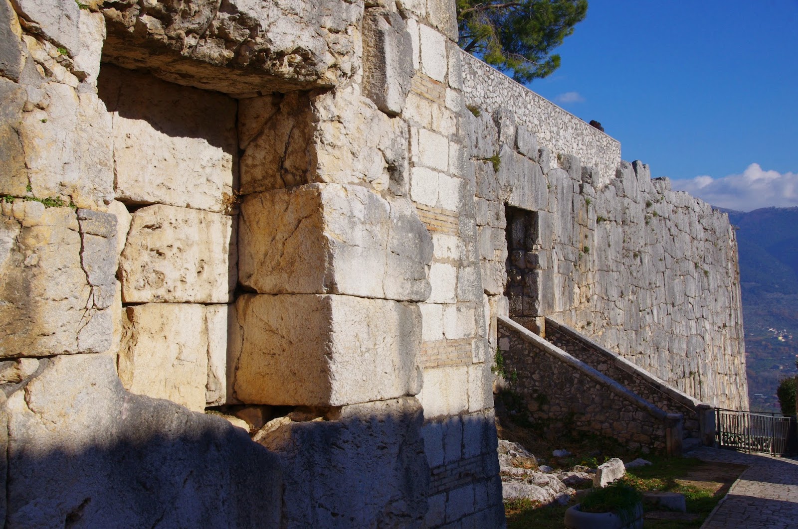
The cyclopean walls of Alatri near the Main Gate of the Acropolis (Porta Maggiore). In the foreground, one of the three enigmatic niches called "The Sanctuaries", which probably once contained statues - Photo by Author
The megalithic gate of the Acropolis of Alatri (Porta Maggiore). The walls reach an height of over 15 meters in this point and in proximity of the corner in the walls - Photo by Author
Who built the cyclopean walls and why? 

The small towns of Alatri, Ferentino, Segni, Sezze, Veroli and Arpino, all in the Province of Frosinone, Norba, Cori and Circei in the Province of Latina, Amelia in nearby Umbria, as far as Ansedonia,  Orbetello and Roselle in Tuscany and Alba Fucens in Abruzzo, are entirely surrounded by cyclopean walls that survive to this day in varying states of preservation. They loom even to this day over 15 meters high on the Acropolis of Alatri, and are almost intact over their entire circuit around Ferentino, Segni and Norba.
  
The stones composing the walls are truly gigantic, each weighting many tons, and as finely fitted together as to leave a few millimeters at most between the joints. But it is their near impossible acute angles and interlocking corners that cause the greatest amazement, as if each stone was individually carved to be a piece of a gigantic jigsaw puzzle.  

Another view of the Walls of Alatri near the Porta San Pietro (Saint Peter's Gate) - Photo by Author
Not much has changed since the time when Ferdinand Gregorovius first described the cyclopean walls of the Acropolis of Alatri as “the most astounding monument of the past in Latium”. It was 1859 when he wrote these words:  “The sight of this marvelous masonry, which equals in size any existing Egyptian building, would amply repay the visitor for the longest and most fatiguing day's journey […] When I walked round this black, Titanic, construction, just in as good preservation now as if years, instead of thousands of years, had passed over them, I was filled with amazement greater than when I first beheld the Colosseum at Rome”. [1]
In over 150 years, very little has changed also in our knowledge of the builders and purpose of these cyclopean structures. The debate on the original builders of Alatri and the cyclopean walls of Latium raged for much of the 19th and the 20th Century. Lacking any other plausible explanation, the construction of the walls was attributed to the Romans of the early Republican period (III – I Century BC) and the whole question was put to rest for almost half a century. Indeed, no other civilization known to historians and archeologists would have had the technical skills and social organization to afford the construction of the miles long walls and to move tens of thousands of stones, some of which weighting in excess of 27 tons.

Yet, whoever visits the little town of Ferentino, still encircled by its beautiful cyclopean walls, would immediately realize that this attribution is plain nonsense. Here one sees more than in any other place three distinct and clearly recognizable stages of construction: the cyclopean, the Roman and the medieval. The inscription of the Roman censors Aulus Lollius and Marcus Irtius still stands to commemorate the restoration of the walls by the two censors in 180 BC. Of course, the restoration was made with relatively small, square blocks of stone upon the already ruined cyclopean masonry underneath, which served as a 10 meters high foundation for the new roman wall.  Even without the inscription, no reasonable person would ever think that the cyclopean masonry and the brick-like stone wall above could belong to the same period, not to mention having been built by the same people! Yet one still reads in guidebooks and even scholarly studies that the two censors built the whole of the walls of Ferentino, including the cyclopean portion. 

The acropolis of Ferentino, where one can clearly see the three layers of construction: the Cyclopean (bottom), Roman, and the Medieval on top - Photo by Author 
Another view of the cyclopean walls of Ferentino, near the Porta Sanguinaria. The arch above the gate is a Roman addition, as also much of the wall above - Photo by Author
Again at Ferentino one can clearly see the three different layers of construction: Cyclopean (polygonal), Roman (with small sized square blocks) and medieval on top. These layers belong to completely different epochs and denote entirely different construction techniques - Photo by Author
Nor did the Romans ever claim authorship of such a feat as building the walls of Alatri, Norba, Segni or any other of the cyclopean cities of Latium. Quite to the contrary, ancient historians had a tendency to attribute these structures, so similar to the great walls of Tiryns and Mycenae, to mythical ancestors like the Pelasgians.

If then the walls were not built by the Romans, who built them? More recent scholarship has shown greater openness towards the idea of a pre-Roman date for the cyclopean walls. The pre-roman peoples of the Hernici and the Volsci are therefore sometimes credited for the construction of the walls. Yet, also this attribution, though much more plausible, appears to rest on very thin evidence.  The Hernici formed a league as far back as 495 BC, until their capital, Anagni, was taken by the Romans in 306 BC. Yet one is surprised not to find even the slightest trace of cyclopean walls in Anagni itself, where the walls – which are with good certainty attributed to the Hernici – are rather built with much smaller square blocks.

Even the ultimate function of the cyclopean walls and acropolises is ultimately shrouded in mystery.  Of course, the immediate thought that comes to mind when seeing a wall is that it might serve some defensive function. Yet, in spite of their grand scale, cyclopean walls would offer very little protection and certainly no better protection than a much more simple structure built of bricks or even wood. Not only are the walls pierced by several gates and lacking towers or any other defensive feature one would expect from a fortification of comparable size, but they even present features that seem to exclude any meaningful defensive function. The author Giulio Magli lists several of this features in his book “I Segreti delle Antiche Città Megalitiche” [Secrets of the Ancient Megalithic Cities]. For instance, the acropolis of Circei lacks any defense on the Northern side, which was therefore entirely open and defenseless towards the mountain. Even the main gate of Norba is too broad, at over 7 meters, to allow any kind of covering unless we imagine a capstone of truly monstrous size as could have never been supported by the side walls (there is ample evidence the builders of the cyclopean walls didn’t know the principles of the arch, or deliberately chose not to use it in their constructions) [2]. These cyclopean walls are much more similar to a sacred precinct, like the themenos of a temple, than to a fortress of any kind. 

The Main Gate (Porta Maggiore) to the ancient city of Norba. Over 7 meters wide, the gate is flanked by a round "tower" to the right of unclear function, which is a masterpiece of polygonal megalithic architecture - Photo by Author 
Another gate in the walls of Norba, facing the cliff, and sormounted by a huge architrave. Also note the very fine texture of the polygonal blocks, each one of which weighting many tons - Photo by Author
This is especially true in the case of the Acropolis of Alatri, undoubtedly the finest of its kind in Italy and among the greatest megalithic realizations in the Mediterranean. Other than the usual absence of any defensive features inside or outside the perimeter of the Acropolis, the only structure inside the precinct of its walls appears to be a large stepped platform. Here is found some of the finest cyclopean masonry in Italy and probably in the world, including a stone with over 15 angles, with joints so tight that they don’t allow even the finest blade to pass between two stones. This platform, called a Hyeron, was clearly an altar of some sort, and is moreover very carefully astronomically and geometrically aligned as to be the virtual center or omphalos of the whole city of Alatri. 

Recent research has shown that the entire city of Alatri was designed after a roughly circular plan, with three concentric walls converging towards the Acropolis. The gates defined a number of axes which show evidence of having been carefully astronomically aligned towards the rising and setting of the Sun at the solstices and equinoxes. A number of stellar alignments also seem to point to the constellation of Gemini, Orion and the Southern Cross, at a time when it was still visible above the horizon in the Northern hemisphere. Also, the golden section was embedded in the design of the Acropolis and its gates.

The stars may shed new light on the age-old question of the dating of the Acropolis of Alatri: A recent archaeo-astronomical study shows that the Acropolis could not have been built later than 1,270 BC, when the main axis of the city and of the Eastern wall of the Acropolis was aligned to the star Polaris, with the North-West wall aligned to the rising of the Sun on the morning of the Summer equinox and its setting on the Winter solstice.  The same study found evidence of an astronomical clock based on the shadow projected by the sun along the tunnel formed by the lesser gate of the Acropolis, also pointing at a date in the XIII Century BC. [3]

Previous studies had already shown that the shape of the Acropolis almost exactly mirrors the profile of the constellation of Gemini.  Even on a grander scale, the position of the towns of Alatri, Atina, Arpino, Anagni and Ferentino (ancient Antinum) matches the same profile of the constellation of Gemini (or, according to other interpretations that also include several other centers of Lower Latium, the constellation Ursa Maior). [4]

The stepped megalithic Hyeron (altar) on the Acropolis of Segni, also sorrounded by massive cyclopean walls, is a good examples of how the altar on the Acropolis of Alatri would have looked like before the Medieval cathedral was built on top of the older sanctuary. Also at Segni a church was built on top of the original Hyeron, partly reusing the walls of a Roman temple to the Goddess Juno Moneta - Photo by Author
According to tradition, these five cities were founded by a legendary king Saturn (sometimes identified with the God of the same name) and are therefore called “Saturnian Cities”. According to the same legend, the tomb of Saturn was located in the town of Atina, which is also surrounded by imposing cyclopean walls of unknown date. 

Following the renewed interest in the megalithic civilization of Central Italy, even UNESCO has taken an interest in the astronomic alignments of the acropolis of Alatri. [5]
Even UNESCO now acknowledges that the cyclopean walls of Lower Latium may be indeed several centuries older than their assumed dating to the Roman period, and laments the lack of a reliable stratigraphy that may shed more light on their true age. UNESCO defines Alatri as “the most spectacular example of the use of geometry and astronomy in planning” and is considering its inscription as a World Heritage site.

A view of the Hernici Mountains from the Acropolis of Veroli - Photo by Author

References:

[1] Ferdinand Gregorovius, Latian Summers (tr. Dorothea Roberts, 1903), http://penelope.uchicago.edu/Thayer/E/Gazetteer/Places/Europe/Italy/Lazio/_Texts/ROBLAT/3*.html, accessed January, 2014
[2] Giulio Magli, I Segreti delle Antiche Città Megalitiche, Newton Compton, 2007
[4] Gianluigi Proia and Luigi Cozzi, “Le Città Cosmiche del Lazio”, Mystero n. 33, february 2003, http://www.circei.it/pagina-27.html, accessed January 2014
[5] UNESCO Portal to the Heritage of Astronomy, http://www2.astronomicalheritage.net/index.php/show-entity?identity=27&idsubentity=1, accessed January 2014

Tuesday, April 30, 2013

Part III: The Great Pyramid


March 20, 2013
El Mirador

After spending the previous night at the camp close to the main ceremonial center of El Mirador, we finally headed off to explore the rest of the gigantic site. Watching sunrise on the morning of the Spring Equinox from the top of the great pyramid of El Tigre, we were surprised to observe the sun rising a few degrees to the left of the pyramid of La Danta. For some reason, we expected to see a somehow exact alignment on the day of the Spring Equinox, which however did not occur. We had no instrument to measure the angle that the sun formed with the pyramid of La Danta as seen from El Tigre, yet it could have been somewhere in the order of 4 or 5 degrees. Certainly further research will be needed on the point of solar and astronomic alignments at El Mirador. 
The sun rises over the jungle on the morning of the Spring Equinox. The great pyramid of LaDanta, shrouded in the morning mist, lies a few degrees to the South from a perfect alignment with the rising Sun as seen from the pyramid of El Tigre
A reconstruction drawing at the bottom of the pyramid of El Tigre illustrates the complex layout of structures and plazas sorrounding the great triadic pyramid in the middle. All the pictures that follow were taken from on top of the uppermost platform circled in the diagram. The Orion correlation theory is also illustrated above, both in the general layout of the structures on the ground and by the angle formed between the three triadic pyramids on top. 
The first rays of the Sun hit the tip of the main triadic pyramid on the uppermost truncated platform of El Tigre.  Recent excavations have revealed a well preserved stone stairway beneath the centuries old structure, now covered with plastic sheets as a protection from the weather. 
Two smaller pyramids rise on both sides of the main pyramid on the uppermost platform,  forming the usual triadic pattern believe to represent the sacred triangle of the constellation of Orion - the place of Origins. Recent excavations have exposed much of the original stonework and part of the stuccoed decoration of this smaller pyramid. 
The three triadic pyramids rest on a gigantic truncated platform forming the complex of El Tigre.  This platform, more than 50 meters high, is the third largest in El Mirador after that of La Danta and the Central Acropolis, and the second highest. It could easily contain the whole Grand Plaza of Tikal. 
A map and panel welcomes visitor at the entrance to the main ceremonial center of El Mirador.
        Short after descending from the pyramid of El Tigre, we encounter Structure 34, also called “Templo Garra de Jaguar – Jaguar’s Paw Temple” because of the stuccoed decorations on the outside. It is one of the most iconic structures at El Mirador, and one of the earliest discovered and to be cleared of vegetation. In spite of its relatively small size, this temple must have played a very important role in royal rituals at El Mirador. Construction of the structure was probably started in 300 BC, even though the temple bears traces of having been built on top of an earlier structure. This temple reveals the full complexity reached by Pre-classic architecture, almost 1000 years earlier than it had been previously thought possible in the lowlands of Guatemala. The upper platform consists of a large temple that must have had a corbel ceiling, and two smaller altar-temples forming a triadic structure (one of the earliest known examples of this arrangement). The stuccoed decoration consists of large glyphs in the shape of a Jaguar’s paw and giant masks, possibly portraying rulers. Traces of red paint can still be seen on top of the stucco. Evidence suggests that a ruler by the name of Yok'noom Yi'ch'ak K'ak or "Great Flaming Jaguar Claw” was responsible for the construction of this temple as a dynastic shrine. At some point, probably around 100 BC, the whole structure was buried underneath a new masonry fill and re-oriented on a North-South axis following the re-arrangement of the grand plaza facing the pyramid of El Tigre. Excavations carried out near the base of the monument have revealed traces of much earlier structures. Archaeologist Richard Hansen found the remains of a wall that must have been buried some time after 200 BC. According to Hansen, “It's a triadic structure 17 meters high that is burying an even older building. […]This is an exposed wall. This has not seen the sun's light since 200 years before Christ. But when they buried it [the Maya], it was already in bad shape”. [1] At the time of our visit, a tunnel could be seen cut into the bedrock at the base of the monument, bearing all characteristics of ancient construction. According to our guide, archaeologists believe this tunnel, whose excavation is still undergoing, may lead to a royal grave deep within the structure, possibly that of the same king “Great Flaming Jaguar Claw” recorded in glyphs found inside the Temple. In 2008, conservation experts at the Mirador National Park erected a large metal and polycarbonate structure to shelter the temple and its fragile stucco decoration from the heavy rains that frequently occur in the region.  


Temple 34, originally facing a large plaza adjoining the pyramid of El Tigre and the Central Acropolis, dates to the pre-classic period and contains some of the earliest and best preserved stuccoed decorations in the Maya world. The giant glyph, repeated on both sides of the entrance stairway, is in fact a depiction of a Jaguar's claw, probably a dynastic symbol of the rulers of Mirador. 
On each side of the stairway, two stone and stucco masks, each over 3 meters high, depict perhaps  a deified ruler or a God with feline traits and protruding teeth and nose. The jaguar's claw glyphs to the left and to the right of each mask are placed in such a way as to resemble giant ears. 
Temple 34 as seen from the uppermost platform, which also contains two smaller pyramids. A modern  polycarbonate structure was built to shelter the delicate stuccoed decorations from the heavy rains.
        As we move further to the East, we approach the great Central Acropolis. Massive mounds covered by dirt and vegetation, some as much as 30 meters high, signal the location of buried pyramids and platforms. The whole Central Acropolis rests on a gigantic platform some 15 to 20 meters above the ground, measuring over 400 meters on its longest side and enclosing an area of some 85,000 m2 comprising over 15 structures.
Structure 313 shares the plaza with two smaller structures (Structures 314 and 315) flanking the main building in the typical triadic pattern. This structure is notable for being one of the few to be partially excavated within the Central Acropolis and for its complex stuccoed decoration. This building, whose earliest layers of occupation date to the early Pre-Classic, seems to have been used as a palace by the aristocratic elite. Several large stone masks decorate the exterior, many of which bearing traces of intentional destruction. 
Structure 313 was a palace for the ruling class, facing the grand Plaza on the central acropolis. It rises in several terraces up to a series of interconnected rooms on the upper platforms. With the exception of the water system, it is the only structure that has been at least partially cleared of dirt and vegetation in the area of the Central Acropolis. 
A large stuccoed stone mask, some 2 meters high, decorates the exterior of Structure 313 on the Central Acropolis.  The mask is again notable for the protruding nose and teeth. During the late pre-classic period, this section of the palace was apparently walled up for no apparent reason, covering much of the original stuccoed decoration that was therefore preserved under the fill. 
        A short distance from Structure 313, on the Central Acropolis, excavations revealed extensive remains of a Water System dating to the Pre-classic period, circa 300-200 BC. During the 2008 field season, excitement mounted as a large stuccoed panel began to emerge from the side of a stairway in a building on the Great Acropolis. The uncovered portion of the panel measures 8 meters long by 6 meters high, and contains depictions of aquatic monsters, fishes, together with an enigmatic figure identified as the "Old God" of Maya mythology and two characters which look as though they were swimming. A large part of the frieze was covered by a stairway built shortly thereafter, probably no later than 200 BC. The two swimming characters were no other than the hero twins of the Popol Vuh, Hunahpu and Ixbalanque. The finding served as a further confirmation of the extremely ancient origins of the Popol Vuh and the Maya myths of creation. In the scene, the twin heroes leave from the Underworld after defeating the Lords of Xibalba, while one of them is carrying the head of their father, Hun Hunahpu. The twin heroes are depicted in the moment of their victory over the Lords of Death, after vindicating their father and about to emerge from the Underworld to turn themselves into the Sun and the Moon. Archaeologists have also uncovered a set of pools complete with locks and drainage channels next to the mural. In the words of Craig Argyle, the archaeologist who first discovered the frieze, “there are no words to describe the beauty this building must have had with its frieze when a part of it was submerged under water, which flowed into the pools below, and where the flow of water allowed passers by to capture the movement of one of the hero twins as he swam upstream”. Other figurations contain an image of the “OId God”, portrayed with the body of a bird and a long beard, and several other images of rain and water deities. According to our guide, an additional layer of the mural, more than 5 meters high, still lays buried beneath the Pre-classic floor, containing a giant Jaguar face mask of which only the upper portion is currently visible.   

The famous frieze of the Twin Brothers from the Popol Vuh decorated the exterior of what must have been a pool of fresh water inside the city's water system. This magnificent relief contains a very complex iconography, with representations of a giant snake and several lesser gods and water creatures. 
        As we leave behind the Central Acropolis and proceed towards the Lion Pyramid, our attention is caught by a number of fragmentary stelae lying on the ground. All of the stelae must have been clearly smashed and broken into pieces as a result of a violent attack. It is still possible to see the scars left on the broken surface of the stelae by some kind of club or weapon. Some of the fragments contain depictions of warriors and a princess making offerings to the effigy of a God or King, which must have originally stood some 2-3 meters high. The few glyphs encountered on the stelae are largely insufficient to reconstruct the history of the rulers depicted. Archaeologist believe that several graffiti found on the stelae, consisting of a couple of round circles connected by lines, are in fact a stylized depiction of the God Tlaloc, the head God of Teotihuacan, probably brought here by invading Teotihuacan warriors - the same who were likely responsible for the stelae desecration.
On the northern side of the Acropolis, a platform built of large flagstones placed in a square arrangement marks the likely coronation spot of the Kings of Mirador and the Kingdom of Kan. From there, the King would have appeared in front of the crowd gathered in the underlying plaza. A large altar with traces of burnt offerings placed in front of a stuccoed throne must have served as the royal seat during the ceremony. Based on the traces of plaster found on the outside of the large flagstones composing the platform, it is likely that each flagstone served as a stela commemorating a specific ruler.   

Shedding light on an ancient mystery. Some of the stelae lie in rows forming a platform that was likely used for the consecration of the kings of Mirador or for public sacrifices. The delicate glyphs can only be seen under particular conditions of light and are barely legible. Still largely undeciphered, they may one day tell the history of this forgotten city and of its kings. 
        From there we moved to the next complex of buildings located next to the Lion Pyramid. This massive structure, more than 50 meters high, is now heavily ruined and still remains unexcavated. The large plaza in front of its Eastern stairway is surrounded by buildings and platforms on all sides. It is believed these structures served as Solstitial and Equinoctial markers, which would make the whole complex a gigantic solar calendar. The very ruined state of these structures does not allow for further speculation until a comprehensive excavation of this compound is carried out. A modern Maya altar was built in the middle of the plaza, where ceremonies are still carried out on specific days of the year - according to our guide.
To the East of the Lion pyramid, several pyramids and mounds comprise the Cascabel Group. The pyramids in this group appear to be steeper than the pyramids in the other groups, and of much more sleek construction. In some places the original stonework is still visible and one can easily make out the contours of the large temples on top from beneath the trees. Many of the walls seem to be built of cemented limestone fragments and smaller stones. However, there are also large limestone walls made of carefully fitted blocks of stone, some of which more than 1 meter long. The most notable pyramid in this group is called the “Little Danta”, because of its similarity to the much larger pyramid of La Danta further to the West. The structure, rising some 35 meters on top of a large platform, has also a triadic temple on top and is accessed by way of a very broad stairway which has been partly cut into the underlying bedrock. Some trenches have been dug at the base of the monuments to uncover the original level floor of the plaza. As of today much of this vast compound remains unexcavated and is still largely covered by vegetation.

The "Little Danta" is in fact a large pyramid approached by a broad stairway resembling that of La Danta. The original masonry consists of large limestone blocks, some of which as much as 2 meters long, carefully arranged in rows and plastered over. 
The pyramids in the Cascabel group are unusually steep and massive. Although still largely covered by dirt and vegetation, traces of the original stonework and limestone masonry are visible near the top and in trenches dug close to the base of the monuments. 
Some of the other pyramids in the Cascabel Group show a different style of construction consisting of massive  retention walls that were later filled with dirt and smaller pebbles. Much of these retention walls still survive intact underneath the jungle canopy.
        The Monos complex, located to the South of the Tigre pyramid, and the Pava group, closer to the great pyramid of La Danta, have been scarcely investigated, even though both pyramids reach an elevation of over 50 meters and face large plazas.
As the heat grows in the afternoon, we take some rest at the Camp eating wild oranges and other fruit gathered along the trail. Shortly thereafter we will be heading to the great pyramid of La Danta, some 4 Km to the East of the Camp and of the main ceremonial center.
Giant entangled tree roots along the ceremonial way to the pyramid of La Danta. Some of these trees can reach as high as a 15 storey building - hiding even the tallest structures from sight. 

The Great Pyramid

The most notable feature along the 4 Km stretch of the trail that separates the main ceremonial center and the Central Acropolis from the pyramid of La Danta, is a large defensive wall pierced by what must have been a fortified gate. The gate is directly connected to the Sacbé leading further East to the pyramid of La Danta and to Nakbé. The defensive wall was apparently surrounded by a moat and possessed several raised platforms serving as towers or observation posts placed at a regular distance from each other. This is a rather unique feature of this site, as very few other Maya cities possessed defensive walls, and almost none possessed towers along the perimeter of the wall. After a further 15-20 minutes’ walk, we finally approach the giant artificial platform supporting the pyramid of La Danta.

The approach to the Great Pyramid of La Danta as seen from below the first terrace. Even from a few hundred meters away, nothing can be seen except the thick jungle canopy hiding the monument from sight.
A very large stairway was partly built and partly cut into the natural bedrock on the approach to the great pyramid of La Danta. 
        The pyramid of La Danta can rightfully claim to be among the largest, if not the largest building in the ancient world by volume, standing at over 2.8 million cubic meters. The dimensions of these monumental complex are impressive: The pyramids itself rests on top of a gigantic platform measuring some 600 by 300 meters, forming a large plaza surrounded by temples and ceremonial structures. Much speculation surrounds the exact nature of this platform, whether entirely artificial or partly natural. If proven to be artificial, it would rank amongst the largest feats of engineering in human history. Accordingly, a similar level of debate surrounds the exact height of the pyramid of La Danta. While prudential estimates put it at 72 meters, this measurement does in fact only refer to the uppermost platform consisting of a giant triadic structure. If the whole four (or five) underlying terraces and platforms are considered, the total height of the monument would surpass 180 meters, making it not only the largest, but also the highest structure in the entire ancient World. Not surprisingly, archaeologist Richard Hansen, referring to the pyramid of La Danta in an interview released to CNN, calls it “An investment of labor unprecedented in the Ancient World”.

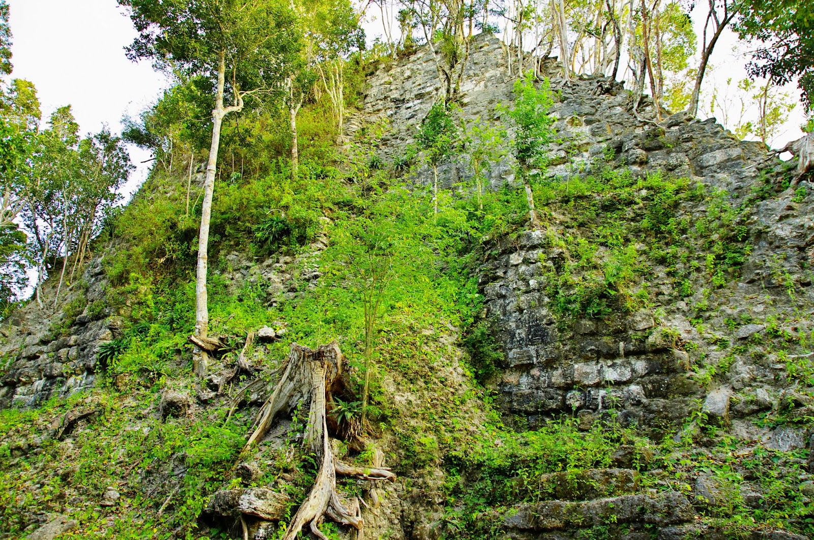
Exposed stonework on the sides of the pyramid of La Danta. The massive stone blocks employed in its construction have allowed the uppermost of the three triadic pyramids to survive almost intact over two thousand years of abandonment and weather erosion. 
From the uppermost terrace of La Danta, it is possible to truly appreciate the massive size of the largest triadic pyramid rising some 72 meters above the jungle canopy. The base of the pyramid lies buried over 4 meters below the present day jungle floor. Smaller chamber were added at a time when much of the monument had already collapsed and its base lie covered in a thick layer of debris.
The lower terrace of the pyramid contains further evidence of the massive stonework, together with remains of the original sculptured decoration, here in the shape of a giant mask with the familiar protruding teeth and nose. 
A much poorer quality masonry fill was added to the original limestone core of the pyramid  when new chambers were added to the lower terraces to accomodate a small residential community after the collapse of Mirador and the site abandonment. The contrast with the neatly fitted stones and layers of masonry in the background is striking and testifies to the advanced building techniques already in use during the Pre-Classic period. 
        The largest of the triadic pyramids on the top platform, still partly covered by trees, rises majestically over the jungle canopy. Again, giant stuccoed stone masks decorate the exterior of the pyramid, some of these clearly bearing the marks of violent destruction. The steep stairway that once led to the top of the pyramid has largely collapsed and is too dilapidated to climb. In its place, a wooden scaffolding was built by archaeologists on the opposite side of the pyramid, from which it is possible to reach up to the top of the monument. The view from the top is breathtaking, stretching over literally hundreds of miles of pristine rainforest.  From this vantage point, the contours of the ancient Maya roads and the profile of the distant ruins of Nakbé and Tintal can be clearly made out, fully revealing the true extent of this vast ruined network. Unlike most Maya structures, consisting of relatively small cemented stones, the casing stones of the pyramid of La Danta are massive, some reaching more than 1.5 meters long and very finely fitted together. The beauty of the ancient stonework can be fully appreciated in those parts of the monument that are relatively free from dirt and vegetation.

Again, the sun sets one more time over this city of the dead.          

Long way up. The impressive view over the treetops from the Pyramid of La Danta, possibly the largest in the world.  The pyramid projects a huge looming shadow over the sorrounding jungle, stretching far away as a giant green carpet.
A closer view of the upper terraces of La Danta. Without the protection of the original limestone casing, much of the interior fill has collapsed uncovering the masonry core of the pyramid.
The sun sets over the jungle from the pyramid of La Danta
References

[1] Mirador National Park website: http://www.miradorpark.com/structure34.htm, retrieved on April 19, 2013.