Saturday, August 11, 2012

Irem of a thousand columns


“6: Have you not considered how your Lord dealt with Aad – 7: With Irem of lofty pillars – 8: the like of which has never been seen in the Land”?
[Q’uran, Ch. LXXXIX, 6-14]

Irem of a thousand pillars (Iram ḏāt al-`imād in Arabic), a city the like of which has never been built in the whole Land (according to the Q’uran) is a lost city shrouded in mystery. According to Islamic lore, King Shaddad, the son of Ad, had the city built as an imitation of Paradise on Earth to compete with God, and received for this heavenly chastise.  
In some versions of the myth, Shaddad and his tribe of giants (or according to some other legends, with the help of a legion of demons (Jinns) built Irem before the time of Adam, thus making it the oldest city on Earth.

    The exact location of Irem is somewhere lost in the Empty Quarter, the desert of Rub al Khali of Southern Arabia, where only by chance can Irem be found by the uninitiated.
Irem also plays an important role in the Necronomicon Mythos.  The fabulous author of the “Al Azif”, the mad poet of Sana’a Abdul Alhazred was credited by Lovecraft for visiting Irem and penetrating its hidden vaults:

“Irem Zhat al Imad, Irem of the Pillars, the great city. I have spent ten years in the heart of the "Roba al Khaliyeh," the empty space, the great southern desert colored "Dahma," crimson. And I have seen the fabulous many pillars of Irem and I have been called "majnun," mad and possessed of the Jinn. Many are the strange and unbelievable marvels that may be seen there. Alas for the earth has swallowed up the City of Pillars, no more do the caravans of frankincense pass by. Many have called it a town of great wickedness, but do they dare comprehend the fabulous?
Irem was an earthly paradise to the initiated. Towers rising high, the great octagonal fort, alas no more! And there were places here of hidden knowledge and of power.
Some say it was built by giants, some by the tribe of Ad, but Irem was here before men and though swallowed she will protect her secrets from the profane, releasing them to the knowing
For there are many levels of existence for Irem, many levels of reality. So Irem of the Old Ones still exists in some form, and is not this great desert, this empty quarter connected to the void.? Cannot a Muqarribun interact with its unseen denizens in the Crimson Desert?” [1]

The tribe of Ad mentioned in the Q’uran bears a close resemblance to the Biblical Nephilim, which were also believed to be a race of giants and credited for building the City of Enoch. In some other traditions it was Cain, the murderer of his brother Abel to found the great city (Genesis, 4,17) which is somehow identified with Baalbek (Heliopolis) in what is today’s Lebanon.
In one of the earliest Arabic accounts of Irem, quoted by Mas’udi in “The Meadows of Gold”, an other striking identification of Irem is proposed with the city of Damascus in Syria:

“Such was the reign of Djeiroun, the son of Saad, the son of Ad, who first settled in the Country of Damas, where he had his capital. There he gathered a great many pillars of marble, white and coloured and had a considerable construction built which gave the name of  Iram of Pillars...Many historians give different opinions on the account of Irem and its location, but I believe that to this day, in the year 332 of Egira, its ruins survive in what is now one of the markets of Damas, close to the door of the Mosque-cathedral called Djeiroun or Gate of Djeiroun.” [2]

    Another interesting reference to Irem in the work of Mas’udi appears in the chapter describing the foundation of Alexandria by Alexander the Great. According to Mas’udi, when Alexander reached the site of what was to become the capital of his new empire, he found the place marked by a great many ruins in the middle of which stood a column of stupendous size bearing an ancient inscription “in Mosned characters, that is to say, in the ancient writing of Himyar and the kings of Ad”. The inscription read:

“I Shaddad, son of Ad, son of Shaddad son of Ad, whose arms have embraced the Earth, I had large columns cut from the mountains and quarries, I built Irem of pillars, a city the like of which was never seen, and after that, I decided to build a city similar to Irem where I gathered all the noblest and fairest of men, the very best of all nations and tribes, because this place was protected by Fate from all disasters and calamities which befell the Earth. But in this grand endeavor I was stopped and thus was my project abandoned […] It was not in front of a mighty king or his innumerable legions that I surrendered, but to Death only because the end of my days had come by the mercy of God”

Again, according to Mas’udi the sons of Ad (also called Adytes) were the first to rule over the Land:

“The great empire of the Adytes was the first to be ever founded on Earth, after that the vengeance of God had exterminated all the infidels by means of the great Flood of Noah” [3]

    The Adytes were, as we said, a race of giants endowed with an unnaturally long life which was proportionate to their height. The ancestral territory of Ad was, according to Mas’udi, bordering Yemen and comprising the land of Sohar (Oman) until the Hadramut. Shaddad, son of Ad, travelled the World, waged war against India and the West and built Irem of pillars in a time before the dispersion of people and languages which followed the episode of the tower of Babel.

    The idea of a mythical city of inexhaustible riches and ruined splendors somehow lost amidst the sands also caught the imagination of the author of the Arabian Nights (or the Book of the One thousand and One nights), which situates Irem in the deserts of Yemen. According to the story told in the Arabian Nights of the fate of many-columned Irem, the city was built by King Shaddad as an imitation of the Earthly paradise and was truly the most splendid and magnificent city ever seen on Earth.

     According to legend, it took 20 years to gather the gold, silver and the precious stones necessary for the construction, and another 30 just to complete the walls. Other 20 years were spent for building all the great palaces and temples and a further 20 years to complete the preparations, furnishing and decorations. When eventually Shaddad was about to enter his new splendid capital with all his retinue, God sent a sand storm (or a thunderstorm, according to other versions), so violent that of this King and all of his tribe was never heard again a single word. It is said, however, that this city still exists in the solitudes of Arabia…
Curiously enough, a city (or Land) by the name of Irem is indeed mentioned in ancient writings, most notably in clay tablets found at the ancient library of Ebla and in Egyptian texts dating to the reign of Sethi I.  It is not clear whether the Egyptian Irem appearing in some New Kingdom texts was one and the same with the Old Kingdom Land of Yam. There are several hypotheses concerning the location of the Egyptian Irem, the most likely being the Upper Nubian valley. There is however research suggesting that Irem may have been a much more distant land, possibly located in what is today Ethiopia/ Eritrea (which was for a period subject to South-Arabian rule from the Yemenite kingdom of M’arib, or Sheba). Still, it is doubtful whether the Egyptian Irem was the same as the many-columned Irem of Arabian legends and mysticism. [4]

    Also, one clay tablet found in the library of Ebla, dating to 2,300 BC mentioned diplomatic and commercial intercourse with the people of “Iram”, even though also in this case the indentification with Irem is doubtful.
    In the early 1980s, researchers looking for ancient settlements along the frankincense route in Southern Arabia found a promising location close to a water well called Ash Shishar, in a site which had been previously identified as a 16th Century fort. The expedition team included adventurer Ranulph Fiennes, archaeologist Juris Zarins, filmmaker Nicholas Clapp and lawyer George Hedges. The team scouted the area on several trips, uncovering remains of an earlier settlement which they believed could have served as an outpost on a trade route to Irem. About 300-500 AD the fort collapsed probably because of a cave-in of the underground water source which had assured its survival in the harsh desert climate for many centuries. Later, the site came to be identified with Ubar, mentioned by Ptolemy in his Geography. There is however no proof that the site was never more than an isolated water hole guarded by a relatively small fort [5]. There is even doubt this remote outpost could be the same as the trading post called Omanum Emporium in Ptolemy’s Geography and believed to be one of the most important stations for the production of Oliban or frankincense.

    As of today, no further clue has been found as to the location of Irem, which has thus come to be designated as the real “Atlantis of the Sands”

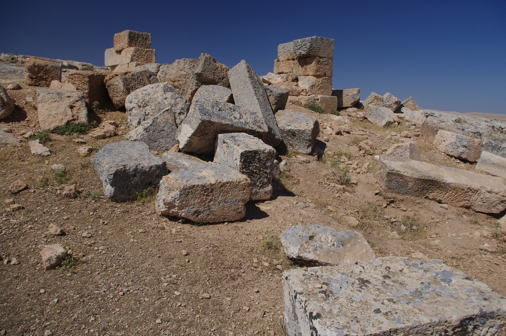
The desert covers the ruins of the ancient city of Dongola, in Sudan. Perhaps a fate similar to that of Irem? - (Photo by Author)
Addendum:

    According to esoteric tradition and some currents of Islamic Sufism, Irem existed in this world as well as on separate levels of existence [6]. In this case, Irem is the gateway to the Void (symbolized in the myth by the Rub al Khali – the empty quarter), that is, to annihilation of the self as a fundamental step towards initiation which can only be entered while in an alterate state of consciousness. To the Muqarribun, Rub-al-Khali is thus the secret door to the Void in Arab magickal traditions and the exact Arab equivalent to DAATH in the Qabalah.
    Also, another possible translation for “Irem of pillars” is “Irem of the old ones”, which is remarkably similar to Lovecraft’s “Old ones” who are supposed to cross the Void to take again possession of the Earth. Was Lovecraft somehow aware of ancient Arabic magickal traditions?

[1] Al Azif, Necronomicon, Book of Places, from http://www.chaosmatrix.org/library/books/necro_proj/
[2] Al Mas’udi, “The Meadows of Gold”, 956 AD, ch. XLVII, ed. Fr. “Les Prairies d’Or”, vol. III, p 271,
[3] Al Mas’udi, cit. ch. XXXVII, vol. III, p. 79
[4] O’Connor, David, “The Location of Irem” in The Journal of Egyptian Archaeology, Egypt Exploration Society, 1986
[5] Leake, Johnatan “Lost Atlantis of the Desert runs into sands of doubt”, The Sunday Times, 20 October 2002
[6] Laurence Galian, The Sun at midnight, Quiddity, 2003

Sunday, August 5, 2012

The Hall of Records: The temple of the Seven Planets at Sogmatar


“At the extreme boundaries of the Earth stands an ancient temple, which is round and has seven doors on each side and a lofty dome which has also seven sides and is famous throughout the land for its extraordinary height and admirable construction.  On top of the dome is a kind precious stone or crystal as large as a bull’s head, dispelling darkness for a great distance…Many great kings of old have tried to get hold of this stone, but with no success: all those who tried, fell lifeless at a distance of 10 feet…even if one uses spears, arrows or other similar contrivances, these similarly stop and fall mid-air at a distance of 10 feet. ..To this date, there is no means for a man could get hold of this stone. Those so daring or foolish to think they could demolish the temple would be struck by instant death. Certain sages explained this phenomenon as caused by certain magnetic stones placed at a regular distance all around the temple[…]
Within the temple is a very deep pit, how deep nobody knows. It has seven sides and is constructed in such a manner that whoever attempts to get too close in order to look down will fall into the deep and thus find his death.  Around the pit is a ring of brass carrying the signs of an ancient writing:
“This pit leads to the Hall of Records, in which all the wisdom of the world is kept since time immemorial. Here is preserved the history of the World, the science of Heavens and the hidden secret of all things past, present and future. In this pit lie all the treasures of the World, but whoever wishes to be worthy of it must be our equal in power, wisdom and science. Whoever is able to do so, then he will know himself as one of our kind. But beware shall you not be worthy, because you will learn how much more profound is our wisdom,  broader our science and impenetrable our vigilance”
This temple, just as its dome, rests on a rock of stupendous size, similar to a great mountain, so hard that no excavation can be made in its sides…Nobody who has seen this ancient temple, can go away without being struck by a great melancholy and unexplained attraction for it”
Al Mas’udi, [897-952 AD], The Meadows of Gold, LXVII – “Sacred buildings and monuments of the Sabians of Harran”

     The first time I read this passage it struck me that if such a temple ever existed, some ruins of it must have survived in the plain of Harran. I was especially intrigued by the reference to a supposed depository of ancient wisdom which so much echoes the traditions of similar “Hall of Records” in Egypt and elsewhere around the World. Knowing that Harran was a stronghold of hermetic tradition and home to one of the major occult universities in the ancient world, it was not difficult to see a link with the long fabled “Vaults of Hermes” mentioned in some ancient Egyptian manuscripts (in the French edition of a rare 15th Century Arabic manuscript by the title of “Livre des Perles Enfouies et du Mystere precieux” there is a very precise reference - in chapter CCXIX – to some ancient depository of knowledge and mysterious artefacts bearing a close resemblance to the pit seen and described by Al Mas’udi some 500 years before).

According to a long established tradition, the wise men of before the Great Flood built vast underground shelters in different parts of the World, so that their secret knowledge and science may not be lost in the Flood. There they remained hidden and undisturbed, according to hermetic legends, for the next 36,000 years…

    There is circumstantial evidence that the Sabians – as the heirs of the ancient mystery schools of Chaldea and Egypt and of late-Hellenistic hermetism – may have discovered one such depositories of ancient knowledge, from whence they possibly derived the earliest known translations of the Emerald Tablet of Thot (“Tabula Smaragdina”) and several other hermetic writings.

    I decided to investigate the legend for myself in June 2012 while on an archaeological expedition to South-Eastern Turkey.

    I first came across a reference to the temple described by Al Mas’udi in an Italian archaeological magazine (“Nel tempio dei sette pianeti”, in Archeologia Viva, n.2, Nov-Dec  1988, by P. Laureano). The author of the article suggested the temple had been found in a remote desert location some 45 Km East of Harran called Eski Sumatar (also spelled Sogmatar). There were no further details except for some reconstruction drawings and a scant description of the place.
I also found a somehow lengthy description and a few pictures of the temple of Sogmatar in Tom Knox’ book “Genesis secret”. The author did not mention anything related to a “Hall of Records” or the temple described by Arabic writers, but mainly focused on a group of strange temples for star-worship placed in a circle around a central mound and a number of highly mysterious rock-cut chambers. He described the site as a somehow “desolate and poetic spot”, being the “most haunted place” he had come across during his travels in Turkish Kurdistan.

    After a full half-day spent visiting the deserted ruins of ancient Harran, we plotted the coordinates for Sogmatar (36°59'41"N 39°20'14"E) into the GPS, which led us through a very bad country road bordered with ancient sites. The local township had even placed panels and signs along the road probably in some attempt to attract a few tourists (there were none around…).
It took over 3 hours to drive the 60 Km between Harran and Sogmatar (with some brief stop-overs at the Bazda caves and the ancient city of Suayb). Of course not much was left of the fabulous temple described by Mas’udi, still it was easy to spot even from a distance the great central mound which must have once supported the ancient temple.

    Seven temples were placed in a half-circle, spaced about half a Kilometer away, around a central mound. The mound, which was clearly the core of the ancient complex is roughly conical, some 150 meters in diameter with an height of perhaps 50 meters. From a distance, it looks like some collapsed pyramids one finds in Egypt and elsewhere: all around are heaps of stone and, under the dirt covering the mound, one can easily find ancient courses of masonry which are a clear evidence of the mound being an ancient structure and not the work of Nature. On top of the mound one still recognizes the faint contours of ancient walls and towers with a polygonal outline: these may be the remains of the seven-sided structure which was still intact in Mas’udi’s time about 1,000 years ago.

    Even in its current ruined state, it still bears a sheer monumentality. The top of the mound is largely unexcavated. Except for the usual heaps of stones, the most notable feature is what seems the entrance to some subterranean or crypt, which is however entirely filled with rubble and covered with large flagstones.

All around, scattered in the desert landscape, lie the seven planetary temples, each one dedicated to a planetary deity and precisely orientated towards the central mound, which also serves as observation point.

A small village was built on the site of one of the planetary temples, probably the one dedicated to the Moon-god Sin. Within the precint of a modest stone hut, one still finds ancient carvings and a cave which was clearly an important place of worship in ancient times. The walls of the cave have been cut square to create a large room with several niches and carved bas-reliefs depicting the heavenly Triad composed of Sin, Baal Shamen (Baal of the Heavens) and Bar Nemre (The Son of the Shining one). The bas-reliefs, as well as the Syriac writings on the walls have been much defaced by the ravages of time and local superstition, but one can still recognize their contours.

Some 50 meters away is the base of another square construction, partly hewn into the rock, of which only the entranceway survives leading to an underground chamber which is however entirely filled with rubble. There is no indication as to which deity this temple was dedicated.

About half a Kilometer to the South-East stands a large circular platform built of hewn stones, all very finely fitted together, marking the spot of Saturn in the heavenly diagram of Sogmatar. According to a recent reconstruction hypothesis, on top of each platform stood gigantic representations of the planetary solids associated to each of the seven Planets (Moon, Sun, Mercury, Venus, Mars, Jupiter, Saturn). Today nothing remains of these solids, but large piles of rubble. The most notable feature of this platform is a descending passage which is free of debris, leading to a small rock-cut chamber deep beneath the circular platform on top. At some point in time, probably during the Roman period, the chamber was turned into a tomb and sarcophagi were cut in the walls. In one of the corners we noticed a small pit entirely filled with rubble, where one could only see the entrance to some underground corridor or crypt. Our guide told us an interesting story on this small pit, which would have otherwise gone unnoticed. It seems that all of the seven temples once possessed a similar pit, leading to a kind of vast subterranean located right under the central mound similar to the spokes of a wheel. According to this tale, which we could not verify, one could go from one temple to another entirely underground, and using this ancient system of tunnels and underground passageways one could even reach as far away as the great Temple of Harran (some 45 Km away) and the rock of Urfa (Edessa), some 70 Km to the North-West.  Unfortunately the ruined state of the tunnels and underground chambers did not allow any further investigation. It would no doubt take many years to clear the tunnels of all the dirt and debris which have accumulated in the course of centuries and millennia. 
Still one finds near Bazda the remains of vast laborious caves and tunnels carved deep into the limestone formations to quarry stone for nearby Harran and Edessa, which suggest something similar may exist underneath ancient Sogmatar.

    Another half Kilometer to the South-East one finds the remains of yet another temple platform, and then a of a third and fourth one spaced about 700 meters from each other. There is one square platform and two circular platforms, all very ruined except the last and most distant one. All of the platforms have a descending passageway leading to some underground crypt, which have however in all cases but one collapsed. Still, it is notable that all corridors were very accurately oriented towards the central mound as we could measure ourselves.

All around each of the platforms one finds a number of highly enigmatic structures, which take the shape of basins, thrones and altars all cut in the living rock. There are also pools and channels which were likely used in some form of bloody sacrifice. We also found several rock-cut inscriptions in what looked like ancient Syriac characters. Some of these were no deeper than scratches on the hard rock surfaces, while some others were deeply cut to a depth of some 5-6 cm in the bedrock, covering multiples lines.
Only a handful of these ancient inscriptions, which look of magical or ceremonial character, have been published. Most notably, historian Theodor Hary found two dates, one pointing at 65 AD and a King Tiridathes, and another bearing the date of May 17, 93 AD. Of the two inscriptions, the latter points to a significant star alignment which occurred on that date which is also reflected in the disposition of the planetary temples on the ground.

    According to Hary, the entire complex was designed at the some point in the 1st or early 2nd century AD to mirror the position of the planets and the constellations in the night sky of Harran, even though the significance and meaning of the entire complex remains ultimately unknown.  Hary also found several bas-reliefs marking the setting of several stars and constellation on the horizon, including a monumental bas-relief showing an horoscope of the constellation of Leo and a double-passageway likely related to the constellation Gemini (see http://theodorhary.com/aktuelle.htm#ee) Unfortunately we were unable to locate the lion relief and the double tunnel mentioned by Hary during our visit in June 2012.

    A great mystery sorrounds the ancient ruins at Eski Sumatar…why was such a remote and secluded location chosen for the greatest of the planetary temples of the Sabians?  And most important, why would an ancient people engage in a work on such a monumental scale as to sculpture natural hills and raise giant mounds of hewn stone for no apparent purpose but to reflect some obscure planetary alignment whose significance completely eludes us?
To me there is little doubt Sogmatar was the same temple that was described over one thousand years ago by Arabian historian Mas’udi. One only hopes that some thorough research and an accurate survey of the ancient site is carried out before it too will disappear under modern encroachment and vandalism.  

Eski Sumatar (Sogmatar) - The great central mound as seen from the village of Sogmatar, in South-Eastern Turkey. The courses of masonry visible on top of the mound and the many heaps of stone are clear evidence of the mound being of artificial construction. In its current ruined state it closely resembles an ancient collapsed pyramid: there are no similar mounds elsewhere in the area in a range of many miles, all being barren and rocky landscape - (Photo by Author)
Eski Sumatar (Sogmatar) - Some of the ancient structures still standing on top of the mound. These are likely the remains of a vast tower-like building similar to the one described by Arabian historian Mas'udi in the 10th Century - (Photo by Author)

Eski Sumatar (Sogmatar) - Some other views of the large constructions on top of the central mound, which clearly belong to a polygonal sided building with multiple turrets - (Photo by Author)


Eski Sumatar (Sogmatar) - One of the circular platforms representing the Seven planetary deities and providing access to a vast subterranean extending across the plain of Harran - (Photo by Author)
Eski Sumatar (Sogmatar) - A square platform, now much ruined, has its descending passage also precisely oriented towards the great central Mound - (Photo by Author)
Eski Sumatar (Sogmatar) - Underneath one of the circular platforms,  we found the entrance to one of the crypts under some rubble and collapsed masonry. Unfortunately all of the underground chambers are entirely filled with dirt and heaps of stones, thus preventing any further exploration - (Photo by Author)
Eski Sumatar (Sogmatar) - Many rock-cut trenches of unknown function can be found next to temple ruins - (Photo by Author)
Eski Sumatar (Sogmatar) - A giant pile of hewn stones is all that remains  of one of the square sanctuaries dedicated to one of the Planetary deities - (Photo by Author)
Eski Sumatar (Sogmatar) - The last and furthest of the underground sanctuaries dedicated to the Planetary deities, also resting on a circular platform - (Photo by Author)
Eski Sumatar (Sogmatar) - On the right side of the platform, resting on a square stepped basis, one still sees the entrance to the descending corridor leading to a collapsed rock-cut chamber - (Photo by Author) 

Eski Sumatar (Sogmatar) - This small square building  is all that remains of the superstructure of the temple dedicated to the Moon-God Sin, which is one of the few to preserve an almost intact cult chamber carved deep into the bedrock


Eski Sumatar (Sogmatar) - Some views of the underground chamber located below the temple of Sin and containing bas-relief representations of the Syrian Gods amidst representations of the lunar crescent - (Photo by Author)
Eski Sumatar (Sogmatar) - Mysterious writings on the rocks overlooking a barren and almost lunar landscape - (Photo by Author)

Eski Sumatar (Sogmatar) - Rock-cut monumental reliefs of Roman or Hellenist origin,  on the hill facing the great central Mound which is also the center of the Complex and the planetary alignment - (Photo by Author)
Bazda Caves - One of the giant rock-cut chambers believed to have served as quarries for buildings in ancient Harran and Edessa, some 50 Km away. This maze of tunnels and chambers extends for many hundreds meters on several levels and is one of the finest examples of ancient stone-cutting technique, located a mere few miles from ancient Sogmatar - (Photo by Author)
The road to Sogmatar - This is actually one of the finest portions...quite telling of the very poor state of roads in this part  of Turkey - (photo by Author)


Suayb - At the ancient city of Suayb, located some 10 Km to the South of Sogmatar, one finds many ruins covering a vast extent. The only building to suggest that a city ever stood on the spot was however a large byzantine house with a few of the original stone frames still in place, all the rest of the site being covered by hundreds of rock-cut tombs and mausoleums, mostly dating to the late Roman period. It is difficult to tell whether Suayb - devoid of any water supply or arable land - was ever a city, or rather a place for burial associated to some nearby sacred site (perhaps Sogmatar itself?) - (Photo by Author)

Tuesday, July 31, 2012

Harran of the Sabians


    The ruins of Harran, which occupies the site of ancient Carrhae, are located some 40 Km South of the modern city of SanliUrfa, in South-Eastern Turkey. Amidst the vast crater of ruins, visible from many miles away, stands a high tower built of solid stone. This is all that remains of what was one of the major occult universities and mystery schools of the ancient world.

Harran - A view of the grand mosque, built in Umayyad period over the ruins of the ancient temple of Sin, with the tower of the Astrologers in the background - (Photo by Author)
     The name of Harran originally came from ancient Akkadian Harrānu, meaning “crossroad”
According to tradition, Harran was first founded by Nimrod, the legendary hero who was credited by Biblical scholars for building the tower of Babel. It was already a flourishing center by the 2nd millennium BC, famous throughout Mesopotamia and the Eastern world for its fabulous temple to the Moon-God Sin. King Nabonidos of Babylon, who was probably himself a native of Harran, turned the city into one of the major centers of his neo-Babylonian empire by the VII century BC, considerably enriching the great temple of Sin.

    In classical times, Harran could benefit from a relative stability due to its cushion status between the Roman empire and Parthia. Harran proved however unfortunate to many Roman rulers: Crassus was defeated just in front of its walls in the plain of Carrhae, while Emperor Caracalla was there assassinated  while going on a pilgrimage to the grand temple of Sin. Another Roman Emperor, Julian, died in a military campaign against the Sassanians in 363 AD, soon after paying his respects to the planetary gods of Harran.
Even in the late IV and V Century Harran was largely immune from the diffusion of Christianity throughout the Eastern Roman empire and became one of the major strongholds of classical paganism. After the edict of Theodosius (389 AD) and Justinianus (529 AD) and the destruction of pagan temples which followed, Harran was taken as a safe refuge by various Gnostic and hermetic sects which had become persecuted in the rest of the empire.
    According to 4th Century historian Libanius, “In the very middle of the city of Carrhae stood a magnificent temple, considered by many the equivalent to the Serapeum of Alexandria…In this temple was a very high tower, which was also used as an observation post because one could see the entire plain of Carrhae from its top… However, when the prefect Cinegius ordered the closure and destruction of all pagan temple in Syria and Egypt, this temple of Carrhae was also partially destroyed, and all of the idols and statues carried away.”
     Notwithstanding the destruction and the sack suffered by hands of the prefect Cinegius, by the early 5th Century the temple had been already reconstructed and paganism re-established to the point that the pilgrim Egeria, writing also in the 5th Century, could not find a single Christian in the whole city of Harran (“sed totum gentes sunt…”).

    The city was clearly established according to a Hermetic ground plan, closely resembling the ideal Hermetic city of Adocentyn whose description is contained in Picatrix. It too had seven gates dedicated to each of the planetary deities (Sun, Moon – considered equal to the planets – Mercury, Venus, Mars, Jupiter and Saturn) according to the principles of talismanic magic. It was circular in shape and had a large temple in its center surmounted by a high tower.
Not surprisingly, even after the rise of Islam and Arabic conquest, Harran became one of the major centers of Eastern and Western hermeticism. An important university was established in Harran as early as the 7th Century, where hermetic scholars were responsible for the re-collection and composition of the large, though widespread Corpus Hermeticum and of various hermetic treatises – most notably the Picatrix – dealing with talismanic and ceremonial magic.

    According to a famous legend, when Caliph Al-Mamum took the city in year 820 AD, the Harranites claimed protection on the basis of being one of the “people of the Book” mentioned in the Quran. When asked who they were, they responded: “we are Sabians”, thus escaping massacre; and adopted thereafter the Corpus Hermeticum as their sacred text.
The name Sabians is likely a derivation from the Coptic Saba’ia, meaning “people of the Stars”, likely a reminiscence of a very ancient star cult which had its roots in the ancient Egyptian religion, the cult of the Magi of ancient Persia and the western Hermetic tradition. The linkage between the Sabians of Harran and Egypt was made even stronger by their annual pilgrimage to the pyramids of Giza, quoted by several Arabic writers, which the Sabians believed were the tombs of Hermes Trismegistus and Agathodaimon built before the Flood.
A famous phrase, written over the main entrance door to the largest temple of Harran could still be read by Arabic historian Mas’udi in 943 AD: “Know yourself, and you will become God”...

    During the 8th Century, Harran briefly took over the role of capital of the Umayyad caliphate under Marwan II, which however lost in 762 when the capital was moved again to Baghdad by Abbasids caliphs. 
Harran survived as a major center of learning and scholarship throughout the 12th and 13th Century, until it was finally sacked and destroyed by Mongolian hordes in 1259, never to be rebuilt.
It happened thus that what for over 3,000 years had been one of the most prosperous and important cities in the ancient near East became a deserted ruin.

Harran - A giant arch is almost all that remains of the grand prayer hall built by Umayyad caliphs on the site of the Grand Mosque of Harran, a building comparable to the Mosque of the Umayyads in Damascus. One frequently finds broken fragments of columns, stelae and reliefs clearly belonging to more ancient temples dating as far as the Babylonian period - (Photo by Author)
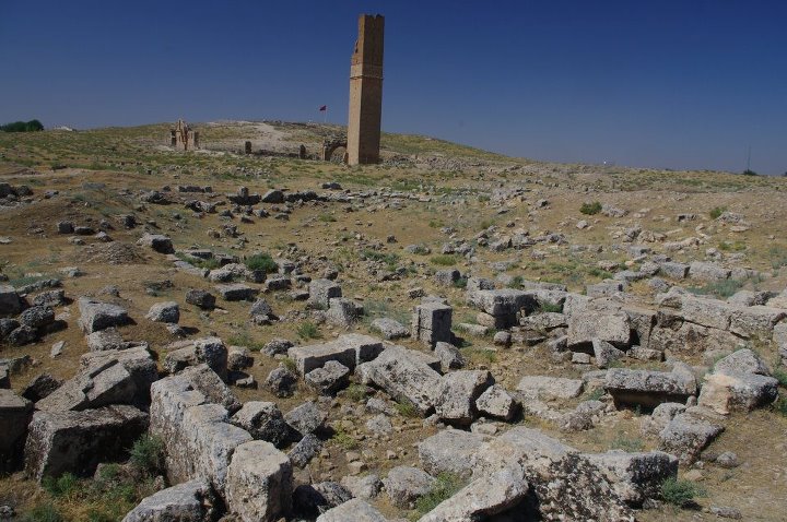
Harran - Amidst the vast crater of ruins, the tower of the Astrologers stands as high as 50 meters over the deserted plain, visible from many miles away. The tower was certainly used for astronomical observations and is the sole remain of the once fabulous temple of the Moon-god Sin - (Photo by Author)
    One barely recognizes amidst the vast crater of ruins which is today’s Harran the wrecked grandeur and magnificence of the ancient city. The most recognizable remain is now the grand mosque occupying the site of what was in ancient times the temple of Sin with its high tower of stone visible from many miles away. The only other notable remains is a vast castle considerably enlarged by Saladin and the Crusaders to the South-East of Harran, whose octagonal towers are most likely all that remains of an ancient temple of the Sabians dedicated to the planetary deities.


Harran - The ruins of the great castle date back to the early Byzantine period. It was later rebuilt by the Crusaders of Edessa and then again by Saladin.  The beautiful octagonal towers have nothing of the severe and austere style of medieval military architecture: they are probably the remnants of some ancient temple of the Sabians - (Photo by Author) 
    To add to the sense of mystery that sorrounds this city of the Dead, several authors have seen a connection between the tower of Harran and the Tower card – striken by bolts of lightning – in the Major Arcana of the Tarots. Another card of the Tarot, the Moon card also bears a close resemblance to a couple of nearby columns located in Sanliurfa and popularly indicated by the name of “Throne of Nimrod”, which were also closely associated to the worship of the Moon-god Sin (these are probably the same pillars mentioned by Jewish-Roman historian Josephus in the land of Siriad as the work of the sons of Seth from before the flood)


Harran - the great tower of the Astrologers overlooking the plain of Harran. Note the similarity with the Tarot card of the Tower struck by lightning...The tarot deck likely originated in the Islamic middle ages, and Harran was one of the major centers of learning and hermetic philosophy at the time - (photo by Author)


Sanliurfa (ancient Edessa) - The two ancient columns that overlook the ancient citadel of Urfa from the top of the acropolis are known by locals as the "Throne of Nimrod", since Nimrod had according to legend his palace on the hill of Urfa. The columns actually date to the 2nd or 3rd Century AD: a Syriac inscription reads "I am Eftuha, son of the Sun, I had these columns rebuilt for me and my Queen...". Recent excavations close to Abraham's pool at the bottom of the acropolis have revealed remains of civilization more than 11,500 years old - (photo by Author)

Saturday, July 28, 2012

Turkey's Marcahuasi: the mysterious City of Midas


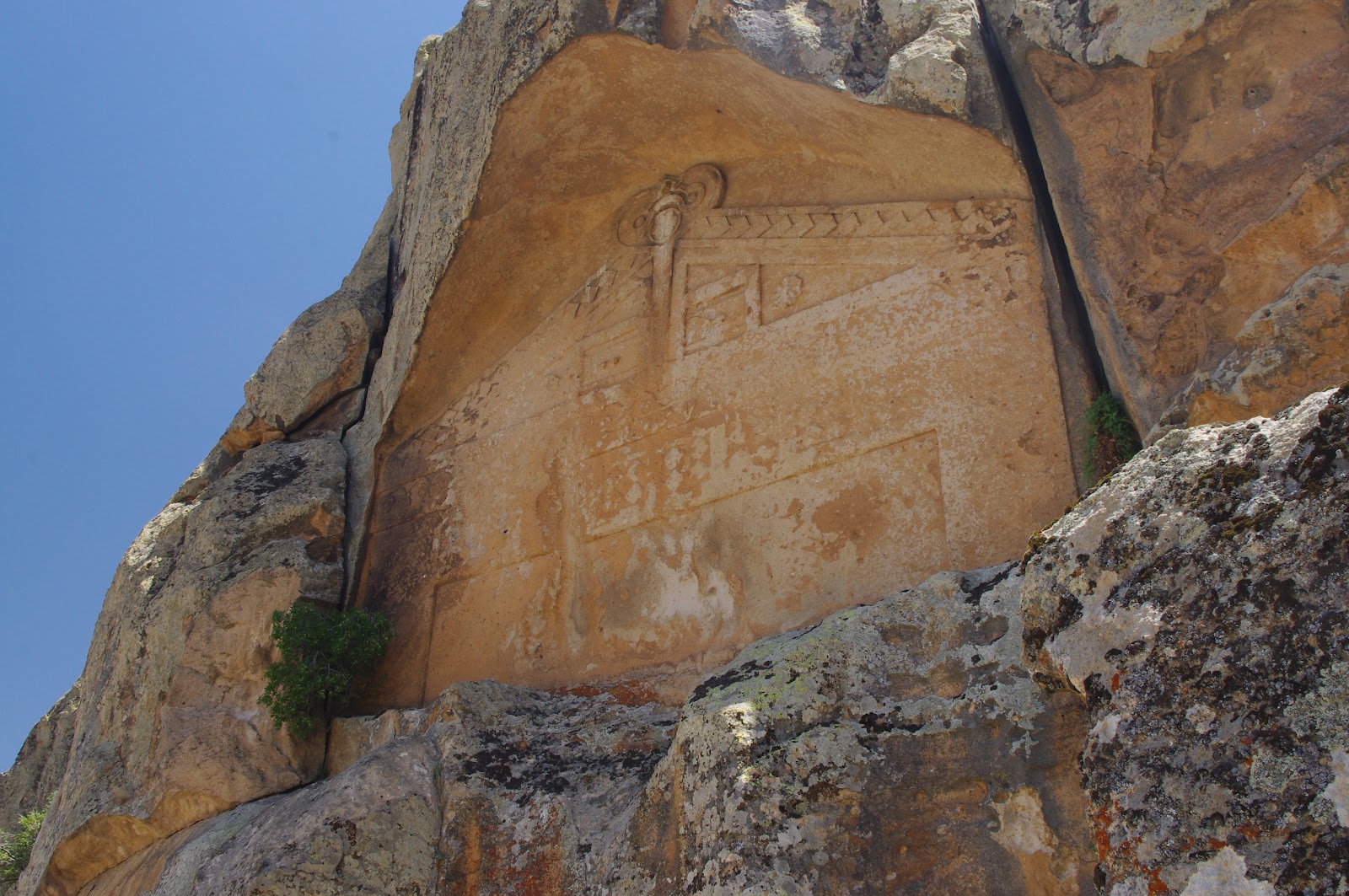
Midas City - The intricate facade of Midas monument is elaborately carved into a square and crosses pattern. The entire structure is now covered in a 7-storey high scaffolding as the monuments is threatened by rain and wind erosion - (Photo by Author)
The “City of Midas” occupies a vast plateau in Central Anatolia close to modern Afyon and Eskisehir. Strange rock formations shaped in ancient times into monumental rock facades and unexplainable stairways and tunnels create a sense of mystery as if dominated by some kind of supernatural power. This is a place of power, where one truly feels the pulse of the Earth in a place which has been since time immemorial the sacred centre of Anatolia. In modern times, the plateau of Midas has been called “Yazilikaya”, which means the “inscribed rocks” – a very appropriate name indeed –

The “City of Midas” is by no means a city in the classical sense. It is a city of the Gods and spirits, not the dwelling place of ordinary people.  There are no houses nor buildings whatsoever. Even though the “City of Midas” is often called a fortress, there is not even a strip of wall to justify such a claim.
Everything there is made of rock and cut into the living rock, as if the rock itself was home to some kind of divine beings. As in Peru’s famous Marcahuasi plateau, odd rock formations take the shape of monstrous beasts and human forms. 

The most famous monument is the so called “Tomb of Midas”: even from a short inspection it is however clear it was never a tomb. The monument takes the shape of a giant rock-cut façade measuring over 16 meters in width and some 20 meters in height. There is a large portal in the façade, which however terminates in a false door which has been partly destroyed by robbers looking for some hidden treasures or chambers. This was most likely a doorway to the spirit world, bearing a close resemblance to other similar monuments in other parts of the world, most notably the famous Peruvian gateway of Aramu Muru close to lake Titicaca (which we also visited in 2007).
A large, yet undeciphered inscription occupies the top portion of the monument, where one clearly reads the name of Midas. It is not clear whether this Midas is the same as the legendary king of the Phrygians which is otherwise supposed to be buried in a large tumulus near Gordion. The inscription, in Phrygian alphabet, closely resembles the ancient Etruscan and runic writings.
The decoration of the façade is a very simple, yet strikingly beautiful geometric pattern made of crosses, triangles and squares. This is an extremely refined composition, which sharply contrasts with the otherwise crude character of Phrygian figurative rock sculpture. 
There is also an unfinished monument, very similar to Midas’, located a few hundreds meters from the main monument on the same rock cliff.

When reaching the top of the “acropolis”, one finds the most unexplainable features of Midas. There are hundreds of meters of stairways cut into the rock and leading nowhere or deep into the Earth, giant stepped altars and thrones. These stairways were clearly intended as ceremonial pathways, and one can sometimes find the fainted remains of reliefs and depictions of pilgrims and robed figures carved into the rock in a very crude and archaic style which  is likely Hittite or pre-Hittite.

Some of these stairways end abruptly on the edge of a cliff, or simply lead nowhere stopping in front of inaccessible rock walls and crevasses. But there are also stairways leading to tunnels deep into the ground of the plateau: these tunnels are of extremely accurate workmanship and have a vaulted ceiling similar to Hittite gateways and tunnels one also finds in Bogazkoy-Hattusas.  In some cases these tunnels intersect at vast underground chambers which, though often called “cisterns” or “underground reservoirs” were surely never used as such. Unfortunately the extensive deposits which have accumulated on the bottom of the tunnels and chambers do not allow to find where they ultimately lead or whether they were intended to serve some other yet unknown purpose.
Turkey is a place of many underground cities, so I will not be surprised if the “City of the Gods” of Midas was in fact another underground city which could only be reached by way of these monumental dwindling tunnels. Phrygians believed their Gods lived deep beneath their mountains: perhaps Midas was held as the original homeland of the Phrygian people and of their national Goddess Cybele whose name literally means “Mother of the Mountain”.

Around Midas’ mysterious city extends the sacred heartland of the Phrygian empire, in the so called “Phrygian valley”: there hundreds of rock-cut chambers, tombs, altars and stairways create one of the most elaborate ceremonial landscapes in the ancient world. This was clearly intended as a sacred and ceremonial space, which was as such deliberately avoided by permanent human settlement.
In some places, like at Aslantaş and Yazilikaya-Midas itself, one has the feeling that some obscure, yet devastating cataclysm ravaged the entire region turning it into a kind of barren and lunar landscape. Giant crevasses opened into the ground, collapsed stairways and tunnels are all evidence of sudden destruction and impending catastrophe. In Aslantaş one wonders at the powerful force of nature that cracked the rocks and made a ruin of the giant rock cut monuments and sanctuaries…

The city of Midas is conventionally dated to the VIII to VII Century B.C., but it may be of any antiquity. The style is somehow reminiscent of pre-Hittite and bronze age construction, but there are also elements such as rock cuts and cup marks which are mostly found in Neolithic sites. Also, when one considers the level of erosion on the facades and the badly eroded rock formations one can only guess at the real age of this mysterious monument…    

Midas City - A rock honey-comb with ancient chambers and passageways located at the entrance of the City of Midas. Thousands of years of wind and erosion have concealed any ancient carvings and structures - (Photo by Author)
Midas City - The facadeof Midas' monument as it looks now, completely covered  by modern scaffolding - (Photo by Author)

Midas City - the "small Yazilikaya", a Phrygian unfinished monument located a few hundred meters from Midas' monument and also shaped as a giant rock-cut portal- (Photo by Author)
Midas City - the pathway to the acropolis is closely similar to the ancient cart-ruts one finds  on the Maltese islands and the Caucasus: two parallel grooves run for many meters from the valley floor to the top of the plateau - (Photo by Author)


Midas City - Various views of the rocky and barren countryside sorrounding the plateau - (Photo by Author)

Midas City - A view towards the ancient tunnels and stairways leading deep into the ground on the flanks of the acropolis. The monumental character of these tunnels, which may be followed for well over 300 meters undeground suggests some highly important, yet unknown function. These may well be an access to some underground vaults similar to the subterranean cities of Cappadocia. There is no element to suggest these tunnels and the underlying chambers were ever intended or used as cisterns and water reservoirs - (Photo by Author)
Midas City - One of the many thrones and rock-cut stairways one finds on the top of the acropolis plateau. There is no clear theory as to the exact purpose of these enigmatic rock-cut structures - (Photo by author)
Midas City - The famous "animal rock" resembles a prehistoric animal or a crouching sphinx. This gigantic rock, located just on top of the acropolis plateau, was clearly the object of a very peculiar cult in ancient times - (Photo by Author)
Aslantas - The vast rocl-cut tomb known as Aslantas resembles a huge cube of rock. The facade is intricately carved with the depiction of two roaring lions around a small entrance door - (Photo by Author)
Phrygian Valley - located close to Aslantas rock tomb, these giant collapsed stones are the sole remains of a vast rock-cut santuary as if destroyed by some kind of cataclysm or sudden catastrophe
Phrygian Valley - A monumental rock-cut tomb carved to resemble a temple facade is located a mere 4 Km from the "City of Midas". This is likely the result of a phrygian portal monument turned into a monumental tomb in hellenistic or early Roman times - (Photo by Author)
Phrygian Valley - One of several rock-cut chambers and passageways located in the valley. This window-shaped structure is likely the result of erosion over some rocl-cut structure. One wonders at how many thousands of year were necessary to completely erode away all the rest of this structure - (Photo by Author)

Kumbet (Phrygian Valley) - Near the hilltop village of Kumbet one finds several rock-cut structures, including  a monumental Phrygian tomb facade depicting lions and eagles - (Photo by Author)